Provinces of Ardabil and Gilan, Iran. Photo credit Mohsen Zare, Tasnim News Agency

Provinces of Ardabil and Gilan, Iran. Photo credit Mohsen Zare, Tasnim News Agency

Photo credit Pouria Pakizeh, ISNA

Isfahan Province, Iran. Photo credit: MEHR

Photo credit Shahram Marandi, ANA

Qom Province, Iran – Photo credit Ahmad Zohrabi, ISNA

Photo credit Mohammad Moheimany, MEHR

Photo credit: Laleh Khajooei, MEHR

Photo credit: Laleh Khajooei, MEHR

Photo credit Pouria Pakizeh, ISNA

Photo credit Pouria Pakizeh, ISNA

Tehran Province, Iran. Photo credit Seyyd Vahid Hosseini, ISNA

Photo credit Farhad Safari, MEHR

Photo credit Farzad Menati, Tasnim

Photo credit Pouria Pakizeh, ISNA

Provinces of Kurdistan, Lorestan and Urmia. Photo credit IRNA

Provinces of Ardabil and Gilan, Iran. Photo credit Mohsen Zare, Tasnim News Agency

Provinces of Ardabil and Gilan, Iran. Photo credit Mohsen Zare, Tasnim News Agency

Provinces of Ardabil and Gilan, Iran. Photo credit Mohsen Zare, Tasnim News Agency

Provinces of Kurdistan, Lorestan and Urmia. Photo credit IRNA

Alborz Province, Iran. Photo credit Abbas Shariati, Tasnim

Fars Province, Iran. Photo credit Tahere Rokhbakhsh, Tasnim

Gilan Province, Iran. Photo credit IRNA

Gilan Province, Iran. Photo credit IRNA

Golestan Province, Iran. Photo credit Mohammad Nesaei, Tasnim

Golestan Province, Iran. Photo credit Mohammad Nesaei, Tasnim

Photo credit Mostafa Hassanzadeh, Tasnim

Photo credit Mostafa Hassanzadeh, Tasnim

Lorestan Province, Iran. Photo credit MEHR

Markazi Province, Iran. Photo credit Amir Hesaminejad, Tasnim

Mazandaran, Iran. Photo credit IRNA

Mazandaran Province, Iran. Photo credit Gholamreza Ahmadi, Tasnim

Mazandaran Province, Iran. Photo credit Gholamreza Ahmadi, Tasnim

Mazandaran Province, Iran. Photo credit Gholamreza Ahmadi, Tasnim

Mazandaran Province, Iran. Photo credit asangardi.com

Mazandaran Province, Iran. Photo credit Mostafa Kazemi, Fars

Photo credit Hossein Mirkamali, Tasnim

Photo credit Hossein Mirkamali, Tasnim
Sources: ISNA I, ISNA II, ISNA III, IRNA I, IRNA II, IRNA III, Tasnim News Agency (TNA) I, TNA II, TNA III, TNA IV, TNA V, TNA VI, TNA VII, TNA VIII, TNA IX, Azad News Agency, Mehr News Agency (MNA) I, MNA II, MNA III, MNA IV, MNA V, asangardi.com, Fars News Agency


")
")
")
")
")
")
")
")
")
")
")
")
")
")
")
")


 - 15")
 - 01")
 - 02")
 - 13")
 - 05")
 - 08")
 - 06")
 - 03")
 - 04")
 - 07")
 - 09")
 - 10")
 - 11")
 - 12")
 - 14")
 - 16")


 in spring 03")
 in spring 05")
 in spring 04")
 in spring 02")
 in spring 10")
 in spring 07")
 in spring 08")
 in spring 06")
 in spring 01")
 in spring 00")
 in spring 12")
 in spring 13")
 in spring 14")
 in spring 29")
 in spring 30")
 in spring 34")
 in spring 36")


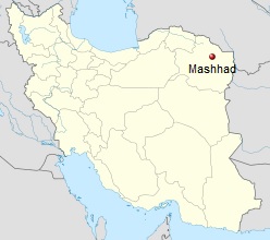 Mashhad (Persian: مشهد) with 3.150.000 inhabitants is the second most populous city in Iran and capital of Razavi Khorasan Province. It is located in the northeast of the country, close to the borders of Turkmenistan and Afghanistan. It was a major oasis along the ancient Silk Road connecting with Merv in the East.


 - Rogers Fund 1938 hb_38.40.247")
 - Rogers Fund 1938 hb_38.40.240")
 - Rogers Fund 1948 hb_48.101.70")
 - Rogers Fund 1938 hb_38.40.290")
 - Rogers Fund 1940 hb_40.170.441")
 - Rogers Fund 1940 hb_40.170.131")
 - Rogers Fund 1938 hb_38.40.137")
 - Rogers Fund 1938 hb_38.40.116")
 - hb_Sabz_Pushan")