Sources: IRNA 1, IRNA 2, ISNA 1, ISNA 2, ISNA 3, ISNA 4, Mehr News Agency (MNA 1), MNA 2, MNA 3, MNA 4, MNA 5, MNA 6, Tasnim News Agency (TNA) 1, TNA 2, TNA 3, TNA 4, TNA 5, Young Journalists Club
Tag Archives: Golestan Province
Jangal-e Abr: Beautiful cloud forest in northern Iran (Photos)
Jangal-e Abr (Cloud Forest or Cloud Jungle) is one of the oldest and most beautiful forests in Iran. It is located on the eastern part of Alborz mountains, on the border between the provinces of Semnan and Golestan, 45km north east of Shahrud.
Sprawling on an area of 35,000 hectares, the Cloud Forest is a remnant of the ancient Caspian and Hyrcanian forests, encircling the northern slopes of the Alborz Mountains like a belt, covering the southern coasts of the Caspian Sea. Inside the thick woods, it is hard to imagine that the forest is located in the semi-arid province of Semnan, close to the Central Desert and Khar-Turan National Park.
When the temperature falls, two or three hours before sunset, clouds rush into the forest. They are so thick that you may not see an arm lenght in front of you. Above them Ghale Maran, a peak of high altitude, seems to be floating on the sea of clouds. It is said that there was ancient castle located on top of this mountain, south of Ramian. After a while into the night, the clouds usually scatter away, letting a clear view of the surrounding valleys, if the moon is up.
Sources: ISNA 1, ISNA 2, irpedia.com, financialtribune.com, tishineh.com, iranlandmark.ir, instagram @chamgir, instagram @yasin_0500, instagram @sshnzk, instagram @arsalanpartovi, anobanini.com, Wikipedia | Jangal-e Abr (in Persian)
Iran’s Golestan Province: Ghale Maran near Ramian (Photos)
Ghale Maran is a peak of high altitude in Ramian County, Golestan Province. It is said that there was ancient castle located top of this mountain, south of Ramian, a 12,000 inhabitants city (2006), in Golestan Province, in northern Iran.
Iran’s Golestan Province: Turkmen Sahra (Photos)
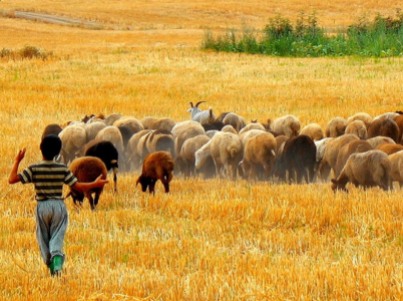
Turkmen Sahra (meaning Plain of Turkmen) is a region located mainly in Golestan Province, reaching to the Provnice of Razavi Khorasan and North Khorasan. It is situated in the northeast of Iran, near the Caspian Sea, bordering Turkmenistan. The majority of the inhabitants of the Turkmen Sahra are ethnic Turkmen. The biggest city is Gorgan which is dominated by Persian inhabitants, though in recent years there has been immigration of Turkmen and Zabuli from southern Iran. Other cities of Turkmensahra are Gonbad (called Kummet in Turkmen), Aqqala (Ak Qala), Kalaleh (Kelala), Gomishan (Kumushdepe), meaning the “silvery hill” in Turkmen, and Bandar Torkaman (Bender Turkmen), generally just called Bandar.
Sources: Tasnim News | Photos, Wikipedia | Turkmen Sahra, Wikipedia | Iranian Turkmen
Iran’s Golestan Province: Kordkuy and Gonbad-e Kavus Counties (Photos)
Kordkuy’s County protected area, Khalid Nabi Cemetery and Gonbad-e Qabus Tower are among the attractions that helped Golestan’s tourism growth.
Jahan Nama is a village with 99 inhabitants (2006) in Chaharkuh Rural District, Golestan Province, Iran. This area is situated in the southern heights of Gorgan and the southeast of Kord Kooy (the Mountain of Kurd). In 1973 30,650 ha in this region were declared protected area.
Wild goat, wild sheep, vension, panther, wolf, beer, owl, eagle, shoulca, weasel, and porcupine belong to the wildlife of this region and some of its plants are: Rosh, Azad, Barberry, Sorkhdar, Kolahe Mir Hassan, Bolandmaza Namdar, Borage Cowslipe, Ras, and Darmaneh. Several studies in the area found 1350 specimens, which included a total number of 607 vascular plant species.
The most important rivers and springs are: Sefid Rood, Tarkan, Mahzi, Chaar Baq, Ziyarat, Marsang, Sbumargah, Shahpasand, Haji Abad, Gachian, Mord Cheshmeh, Vara, Khosh Dasti, Kalichal, Qormehtou, Pazeebon.
Gonbad-e Qabus Tower is a monument in Gonbad-e Qabus, Iran, and a UNESCO World Heritage Site since 2012. The Tower in the central part of the city reaches 72 metres (236 ft) (including the height of the platform).
The baked-brick-built tower is an enormous decagon building with a conic roof, which forms the golden ratio Phi, that equals 1.618. The interiors contain the earliest examples of Muqarnas decorative styles. The decagon with its 3 meter-thick wall, divided into 10 sides, has a diameter of 17 m . The Tower was built on such a scientific and architectural design that at the front of the Tower, at an external circle, one can hear one’s echo.
The tower was built in 1006 AD on the orders of the Ziyarid Amir Shams ol-Ma’āli Qabus ibn Wushmgir. It is located 3 km north of the ancient city of Jorjan, from where the Ziyarid dynasty ruled. The tower is over 1000 years old.
Khalid Nabi Cemetery (in Persian: cemetery of the prophet Khaled) is a cemetery in northeastern Iran’s Golestan province, roughly 65km northeast of Gonbad-e Kavous, in the Gokcheh Dagh hills of Turkmen Sahra. It is mainly situated on a mountain ridge about 1 km distance from the mausoleum called “Khaled Nabi” who according to oral tradition of the Yomut Turkomans was a pre-Islamic prophet (payghambar).
The cemetery was visited in 1979 and 1980 by the archeologist David Stronach . He found over 600 standing stones which are spread out in several locations. About half of them are on the ridge which he calls ” High Plateau ” South and south-east of that are small groups of stones on several other ridges and hillocks. At some distance there is another group of perhaps 150 stones which are distributed over a wide area on the south side of the mountain. Stronach noted two types of gravestones on the site. In both he saw “highly stylized representations of people.”
In popular media the stones are often described as examples of phallic architecture and a major tourist attraction. Touristic visitors often have perceived the cylindrical shafts with the thicker top as depictions of male phalli. This gave rise to popular guesses about preislamic fertility cults as background to such perceived depictions. Consequently the rounded, second type of stones were attributed to female forms and graves. Such descriptions have added to the popularity of the site for visitors from distant parts of Iran. The cemetery is now a national heritage site protected by the Iranian government.
Sources: Mehr News Agency | Photos, Wikipedia | Khalid Nabi Cemetery, Wikipedia | Gonbad-e Qabus Tower, Wikipedia | Jahan Nama
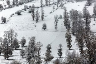
Photo gallery: Winter in Iran – Chahar Bagh, Golestan
Chahar Bagh is a village in the Central District of Gorgan County, Golestan Province, Iran. Gelestan, located in the north-east of the country south of the Caspian Sea, enjoys a temperate climate most of the year. Geographically, it is divided into two sections: The plains, and the mountains of the Alborz range.
Source: Mehr News Agency | Photos, Wikipedia | Golestan Province
Iran’s Golestan Province: Gorgan County – Sunflower Farm (Photos)
Photo Series: Autumn in Iran – Gorgan’s Alang Darreh Park, Golestan Province
Gorgan is the capital of Golestan Province, Iran. It lies approximately 400km to the north east of Tehran and some 30km away from the Caspian Sea. It has a population of ca. 270.000 inhabitants. Some 150 km (93 mi) east of Gorgan is the Golestan National Park.
The city was named Hyrcania in ancient Greek records, the equivalent of the local name Varkâna “Land of the Wolves” in Old Persian. Although modern Gorgan is only a city and county sharing the same name, ancient Hyrcania was the name of a greater region on the southern shores of the Caspian Sea (encompassing all of the present day Golestan province, as well as some eastern parts of the Mazandaran province, and some southern parts of the present day Republic of Turkmenistan). Until 1937 the city used to be known as Astarabad.
Only 5km southwest from Gorgan, covering an area of approximately 185 hectares is Alangdareh Park. These beautiful autumn pictures were taken there.
In general, Golestan has a moderate and humid climate known as “the moderate Caspian climate.” There exist three different climates in the region: plain moderate, mountainous, and semi-arid. Gorgan valley has a semi-arid climate.
Gorgan (as well as the whole Golestan province) has a world-famous carpet and rug industry, made by Turkmen. The patterns of these carpets are derived from the ancient Persian city of Bukhara, which is now in Uzbekistan. Jajim carpets are also crafted in this province.
Sources: Wikipedia | Gorgan, Mehr News Agency | Photos
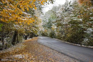
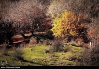
Photo Series: Autumn in Iran – Golestan Province
Golestan Province is one of the 31 provinces of Iran, located in the north-east of the country south of the Caspian Sea. It has a population of 1.6 million (2006) and an area of 20,380 km². Its capital is Gorgan. Present-day Gorgan was called Esterabad or Astarabad until 1937.
Golestan enjoys mild weather and a temperate climate most of the year. Geographically, it is divided into two sections: The plains, and the mountains of the Alborz range. In the eastern Alborz section, the direction of mountains faces northeast and gradually decreases in height. The highest point of the province is Shavar, with a height of 3,945 meters.
The Caspian Sea, the worlds largest landlocked lake
“Caspian Sea, the largest landlocked lake in the world, is located in northern Iran. The Iranian Caspian coast including the three littoral provinces of Gilan, Golestan and Mazandaran, with its thick forests and large-scale rice paddies presents a striking contrast to the dry inner plateau of Iran.
A four-hour drive from Tehran, the Caspian is Iran’s Riviera, with a narrow plain of paddyfields and orchards separating the sea from forested mountains where bears and leopards roam around ruined Mongol castles.”
Also: Wikipedia | Caspian Sea


