Tag Archives: Travel

Iran’s Kerman Province: Beautiful yardang landscape near Shahdad (Photos)

Shahdad Desert, on the western edge of Lut Desert, is home to unique natural structures called kalut (sand castles) by locals. The area is regarded as an archeological site of Kerman Province with graveyards, forts, and caravanserais which date back to the fourth millennium B.C.

The Lut Desert is a large salt desert located in the provinces of Kerman and Sistan and Baluchestan, Iran. It was inscribed on UNESCO’s World Heritage List in 2016. The hottest part of Dasht-e Lut is Gandom Beryan, an approximately 480km² (190 sq mi) large plateau covered in dark lava, 80 km north of Shahdad city. According to a local legend, Gandom Beryan (toasted wheat) originates from an accident where a load of wheat was left in the desert which was then scorched by the heat in a few days. The surface of its sand has been measured at temperatures as high as 70 °C (159 °F), making it one of the world’s driest and hottest places.

These impressive formations which are scattered over 11.000km² across the desert are called yardangs. They form by erosion in environments where water is scarce and the prevailing winds are strong, uni-directional, and carry an abrasive sediment load.

Sources: Wikipedia | Lut Desert, Wikipedia | Yardang, Iran Front Page, BORNA News, wikimedia.org, irandeserts.com (in Persian), untoldiran.com, Mehr News Agency, 500px.com, panoramio.com

Iran’s National Botanical Garden in Tehran (Photos)

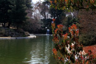
Founded in 1968, the garden extends over an area of about 150ha (370ac) and is planned to be the main center for horticulture and plant taxonomy in Iran.

A herbarium of Iranian plants is gradually being built up and now consists of some 160,000 species. It also contains gardens of non-Iranian plants, an arboretum, six lakes, hills (to represent the Alborz and Zagros mountains), a rock garden, a waterfall, a wetland, a river about 1 km long, systematic area, fruit garden, picnic area with some pavilions, desert plants areas, a salt lake and a wadi (a dry, ephemeral, riverbed that contains water only during times of heavy rain). The botanical and horticultural library has more than 11.000 volumes.

The area, located at 1320m altitude by the freeway between Tehran and Karaj, is flat and slopes gently to the south. The Albourz Mountains forms the background. The climate is dry with an average annual precipitation of about 240 mm falling between November and May. Temperature reaches as much as 42–43ºC during July and August. During winter the temperature may fall to –10ºC or lower. The natural vegetation of the area is dry Artemisia Siberia steppe.

Sources: Research Institute of Forests and Rangelands, Wikipedia, instagram @nbgiran, Mehr News Agency (MNA) 1, MNA 2, MNA 3, Tehran Picture, tishineh.com, netbaran.com, behtarynha.com

Kariz-e Kish: An underground city in Kish Island, Iran

A stone doorway opens up into a maze of walled passages and clear openings that is now partly open for tourists. It is actually an ancient underground aqueduct in Kish, a resort island in Hormozgan Province, in the Persian Gulf.

The kariz of Kish is said to have been built about 2500 years ago by the inhabitants of Harireh City. They stroked the coralline layers of the island in search of water and built the qanat to channel fresh water to their homes and farms. For centuries afterwards, this water not only relieved the thirst of the local residents, but by exporting it to neighboring states, they bartered it for sugar or cash.

Before the Roman aqueduct, the people of pre-Islamic Iran had developed their own hydraulic system called kariz (qanat). The technology spread then eastward to Afghanistan and westward to Egypt. A qanat taps underground mountain water sources trapped in and beneath the upper reaches of alluvial fans and channels the water downhill through a series of gently sloping tunnels, often several kilometres long, to the places where it is needed for irrigation and domestic use. Although new qanats are seldom built today, many old qanats are still used in Iran and Afghanistan, mainly for irrigation.

The ancient water management system in Kish collected water from 274 wells in an area of 14km² and conducted the water to a central refining shaft filled with three layers of filter material. The top layer was coral gravel which was used to neutralize the acids in the water and filter bigger solids in the water. Then a layer of coral grit with clay was filtering fine solids, and the lowest layer was made of marl, a special sort of clay.

Sixteen meters below the coral island, the tunnels, which have been reinforced for safety, snake through the island for over five miles, creating a subterranean world. Its ceilings, once a seabed, are eight meters high and mostly covered by fossilized shells and corals. Tests conducted on these fossils at the Technical University of Munich, Germany, determined that they are from 53 to 570 million years old.

Kish has a history of about 3.000 years, over this time it has been called under various names such as Kamtina, Arakia, Arakata, and Ghiss. The island has an estimated population of 26.000 residents and about one million visitors annually.

Kish Underground City is located at the Olympics Square, on the intersection of three aqueducts with 74 wells over an area of 10km². Efforts have been made to preserve the traditional and historic fabric of this site while providing new uses with museums, art galleries, handicraft workshops, traditional and modern tea and coffee shops for tourists. Nevertheless, the developers have not forgotten its ancient function; the kariz is again fulfilling its role as a water filter, although the filtered water is used mainly for irrigation purposes.

Sources: Ancient Origins, Atlas Obscura, Daily Mail, Encyclopaedia Britannica, Facebook @Kariz.Kish, Fars News, Flickr @ashkan-kankash, Flickr @maissam, Flickr @watoo-watoo, Hamgardi, Hidden and little known places, Historical Iran, ISNA, Kish Underground City, Mehr News Agency (MNA) 1, MNA 2, Panoramio @Nasser Emami, Tasnim News Agency (TNA) 1, TNA 2, Tishineh, Untold Iran, Wikipedia, Young Journalists Club

Hiking in Iran: Landi waterfall in Chahar Mahal and Bakhtiari Province (Photos)

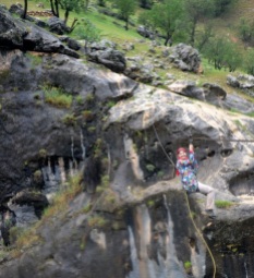
Landi is a 700-inhabitants village surrounded by beautiful nature in Ardal County, Chaharmahal and Bakhtiari Province, Iran. A one night hiking trip away from a waterfall surrounded by pristine nature.

Photos: Road and hiking trip – From Tehran to Landi Waterfall

Sources: Mehr News, Wikipedia | Landi Village, anobanini.com 1, anobanini.com 2 (in Persian)

Iran’s Alborz Province: Dizin Ski Resort hosts snowboard competition (Photos)

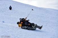
Iran hosted earlier this month a snowboard and freestyle ski competition event in Dizin Ski Resort, north of the capital Tehran. Eight female and twenty eight male athletes competed alongside, defying the unexpected, unfavorable weather conditions at the beginning of the tournament.

Dizin, established in 1969, is one of the larger Iranian ski resorts in the Alborz mountain range, 120km from Tehran by car. The ski season in Dizin lasts from December to May, because of the resort’s high altitude.

Related article: The other Iran | Dizin Ski Resort

Sources: IRNA, Mehr News Agency (MNA) 1, MNA 2, Tasnim News Agency, Fars News Agency, Young Journalists ClubISNA, PressTV

Photos: Sand sculptures in Kish Island, Iran

Kish is a duty-free, resort island in the Persian Gulf 19 kilometers from mainland Iran, in Hormozgan Province. It has a population of 26,000 residents and about 1 million visitors annually. The island is located on a narrow strip of tropical vegetation in the Northern Hemisphere and has a semi-equatorial climate. Along its coast are coral reefs and many other small islands.

Sources: kish.ir, Tasnim News Agency, Mehr News Agency, Wikipedia | Kish Island

Isfahan Music Museum (Photos)

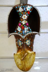
The Music Museum in Isfahan is a private museum opened thanks to the efforts of two masters in traditional Iranian music. The museum is divided in different sectors: national and local instruments, photgraphs, a teaching music hall and a rehearsal hall.

Listen to traditional Iranian music here: The other Iran | Music

Sources: Mehr News Agency, isfahanmusicmuseum.com (in Persian)

Photo series: Winter in Iran – Savadkuh County, Mazandaran

The Veresk Bridge and the Three Golden Lines, a railway spiral passing three times by the same area at different heights are located in Savadkuh County, Mazandaran Province. They are part of the Trans-Iranian Railway, a major railway building project that started in 1927 and completed in 1938. It links the capital Tehran with the Persian Gulf and Caspian Sea.

The Danish firm Kampsax began constructing Veresk Bridge in 1934. The structure stands at 110m height and has a 66m long arch. It connects two mountains in the Abbas Abad region.

The construction of this bridge included craftsmen of many nationalities. The name of the bridge is derived from the name of a Czechoslovakian technician whose name was hard to pronounce for Iranians. Near the bridge is a memorial for the workers who lost their life while building the bridge and its nearby tunnels. The Chief Engineer, Austrian Walter Aigner, following his wishes, is buried in the local cemetery of Veresk.

During World War II, it was known as the Pol-e-Piroozi, or the bridge of victory. During the course of the war, Reza Shah was asked by Hitler to blow up all tunnels and bridges, including the Veresk Bridge, on Iran’s railway lines in order to delay the transfer of goods and reinforcement troops to the north for the Russians. He furthermore promised to replace and reconstruct all of such demolished structures following the Germans’ victory in the war. Reza Shah rejected the request. Today trains connecting Tehran to Gorgan or Sari pass over this bridge an average of four times a day.

Sources: Wikipedia | Veresk Bridge, Borna News, highestbridges.com, fouman.com, Wikipedia | Trans-Iranian-Railway

Photo series: Winter in Iran – Enjoying the snow in Sepidan, Fars Province

Sepidan, which means “The Whiteland” in Persian, is a County located in the Zagros Mountains, in Iran’s Fars Province.

The beauty of the region – Sheshpir Lake, vineyards, forests and rivers – coupled with the mild climate in the summer makes Sepidan a popular destination for ecotourism. Roanj and Barmefirooz, 3.720 and 3.706 meters above sea level, are the highest peaks of the county and are covered with snow throughout the year. Margoon Waterfall, Beheshte Gomshodeh (Lost Paradise) and Pooladkaf, one of the best ski resorts in south Iran are at the foothills of these peaks.

Though Sepidan is visited mostly for its nature and landscapes, it can be a destination for historical and archeological tourists. Anshan, which is considered the Cradle of the Achaemenid Empire and Golbahar Tower, built by the Safavids are located also in this county.

Sources: Borna News, ISNA 1, Wikipedia | Sepidan (in French), Wiki Voyage | Sepidan

Photos: Hiking in Iran – Shirbarfy (Snow Lion) near Borujerd

Borujerd is located on the Silakhor Plain, the largest agricultural land in Iran’s Lorestan Province, at approximately 1670 meters above sea level. The Zagros Mountains surround the city from South East to North West. The city of Borujerd is one of the oldest cities in Iran. It owes much of its early development to the Jews that fled to Persia from Mesopotamia.

The people of Borujerd speak mostly the Borujerdi dialect – a distinctive dialect between Lori and Farsi affected by the specific accent common among the Jewish population of Borujerd – Luri, Laki, and the local Judæo-Iranian dialect can be heard as well.

For other posts on nature in Iran click here: Iran’s diverse nature

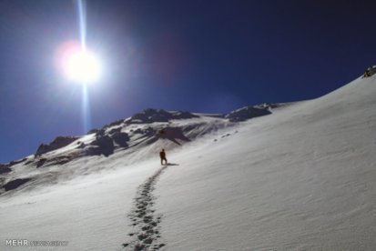
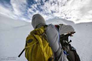
Photos: The mountains and peaks on the way from Borujerd to Bayranshahr (Chaghalvandy) – along the villages of Zereshgah, Chenarestan, Keyvareh and Buryabaf – are a popular destination for hikers during winter. They are called Shirbarfy (snow lion) and are located at 2995 meters above sea level.

Sources: Wikipedia | Borujerd, Wikipedia | Shirbarfy (in Persian), Mehr News Agency (Photos),

Photo series: Winter in Iran – Dizin Ski resort

Dizin is one of the larger Iranian ski resorts in the Alborz mountain range, near Tehran (43 miles north of the capital city) and also near the city of Karaj. It was established in 1969.

The ski season in Dizin lasts longer than in European ski resorts, from December to May, because of the resort’s high altitude. The highest ski lift reaches 3,600 m (11,800 ft), making it one of the 40 highest ski resorts in the world.

The lowest point of the region is 2650m, while its highest point is 3600m, (which equates to 11,811 feet above the sea level). The snow quality at Dizin is fantastic powder and rivals that of many European and Rocky Mountain snow areas.

The Dizin ski complex is the first ski and winter sport resort in Iran which has been officially recognized and granted the title by the International Ski Federation (FIS) for its capability in administrating official and international competitions. At the present, the Dizin ski region is administered by Iran Ski Federation. The FIS Grass Skiing World Cup is also organized in Dizin since 2012.

Sources: Wikipedia | Dizin, Mehr News Agency | Photos 1, Mehr News Agency | Photos 2

More info on: TripAdvisor | Attraction Review | Dizin

Photo series: Autumn in Iran – Snow in Tabriz

Tabriz, located at an elevation of 1,350 meters above sea level, is the capital of East Azerbaijan Province and the most populated city North-Western Iran. With cold winters and temperate summers, the city is considered a summer resort.

Photo gallery: Tabriz covered in early autumn snow

Related content: The other Iran | Tabriz, The other Iran | East Azerbaijan Province

Sources: JameJam Online, Tasnim News Agency, Mehr News 1, Mehr News 2, Wikipedia | Tabriz

Photo Series: Autumn in Iran – Snowfall in Masal, Gilan

Masal, a county in the western part of Gilan Province, encompases the upper valley of the Shanderman River and the whole catchment basin of the Masal River (also called Ḵālekāi) until its arrival into the plain. The local population, 48,000 inhabitants in 2006, speaks Talysh, Gilaki and Persian. Masal and Bazar Jomeh are the only cities in the county.

The main agricultural production is rice, cultivated in the lower valleys and the edge of the plain, in small holdings. Of the three usual complementary resources of the plain (namely sericulture, tobacco, and tea), sericulture is the only one to have had a significant but highly variable role. The impact on this area of the crisis of silk production in the late 2000’s is uncertain. The other main activity and source of income is stock-breeding.

Unlike the valleys adjacent to the north or to the south, this area has no temporary bazaars on summer pastures because of the strong attraction and relative proximity of the Friday bazaar in Shanderman and Saturday bazaar in Masal. In both cases, this commercial activity has launched an urbanization process by gradually gathering services and resident population around the commercial core.

Sources: JameJamOnline, Instagram, Wikipedia | Masal County, Enciclopædia Iranica | Masal

Iran’s South Khorasan Province: Kolah Farangi, Birjand

The Kolah Farangi Citadel is located in Birjand in South Khorasan Province. It was built during the late Zand and early Qajar era between the years 1848 and 1895. The structure is a unique landmark of Birjand and was constructed by Amir Hassan Khan Sheybani. It consists of the garden, the stable, the bathhouse, the offices, and the reception hall.


The building has a hexagonal base, a white conical top and is six stories high. The main entrance is preceded by a roofed area containing some eye-catching arcs. The interior of the ground floor has a number of different rooms which are connected by hallways. In its center there is a room containing a pool which can be accessed from many different entrances. It is situated approximately a meter lower than the rest of the floor and is octagonal in shape. The pool helps keep optimum ventilation throughout the building.

The Kolah Farangi Citadel is registered as national cultural heritage site number 1880. Today it is used as Southern Khorasan’s governorship offices and storage space.

Sources: Dream of Iran, Historical Iran

Glassware and Ceramics Museum of Iran in Tehran (Photos)

The Glassware and Ceramics Museum of Iran is situated in a garden with a span of 7000 square meters. The building was constructed as a private residence about 90 years ago upon orders of Ahmad Qavam (Qavam-ol-Saltaneh). It later housed the Egyptian embassy and was converted into a museum in 1976 by three groups of Iranian, Austrian and French architects.

The museum’s main building, a two-storey octagonal construction with suspended pillars and a basement, occupies an area of 1040 square meters. Its architectural style is a combination of the traditional Iranian style and the European architecture of the 19th century.

The collection of glass and clay works that are on display at the museum is among the rare collections in Iran, mainly from Neishabur, Kashan, Rey and Gorgan. It comprises clay pots dating back from the 4th millennium BCE up to the present time as well as glass works from 1st millennium BCE up to the contemporary era. European glass works belonging to the 18th and 19th centuries are also parts of the collection.

Sources: Tehran Press Agency, Glassware and Ceramics Museum of Iran, Iran Chamber Society, Lonely Planet

Beautiful landscapes on the road from Pounel to Khalkhal (Photos)

Pounel (Poonel or Punel) is a village of 2,300 inhabitants in Rezvanshahr County, Gilan Province, Iran. Khalkhal lies in the eastern part of the historical Azerbaijan plateau and with a population of 38,521 (2006), is the capital of Khalkhal County, in Ardabil Province.

The main ethnic groups living in Khalkhal are Azeris (95%), followed by Talishs and Tats (3%), Kurds (1%) and Persians (1%).

The road from Pounel to Khalkhal has wonderful sights that can be enjoyed by car. If you like hiking, you can visit Ardeh, a village thirty kilometers from Pounel, with beautiful hiking trails.

Sources: IRNA, Instagram, Panoramio | Alireza Jahaveri, Panoramio | Ali Memari, Panoramio | Peyman Azimi, Wikipedia | PunelWkipedia | Khalkhal, Iran Travel Information Forum

Iran’s Isfahan Province: Kashan – Fin Garden Series (2nd photo gallery)

Fin Garden, located in Kashan, Iran, is a historical Persian garden completed in 1590. It is the oldest existing garden in Iran. Unesco declared the garden a World Heritage Site in 2012.

Related post about Bagh-e Fin (Fin Garden) with more information and photos:
The other Iran | Kashan – Fin Garden Series

Sources: Wikipedia | Fin Garden, Mehr News Agency | Photos

Badab-e Surt Spring, Iran – naturally formed staircase built over thousands of years

Badab-e Surt’s springs are two distinct mineral springs with different natural characteristics, located at 1,840 metres (6,040 ft) above sea level in Mazandaran Province in northern Iran

Over the course of thousands of years the water from these two springs emanating from the mountain range have combined and resulted in a number of orange-, red- and yellow-colored pools shaped as a naturally formed staircase.

Other interesting photos of Iran: The other Iran | Photos

Sources: Wikipedia | Badab-e Surt, Bing (pictures)

German broadcaster, DW’s Dan Hischfeld, shares his experience in Tehran, Iran

The taxi ride from the airport to the center takes about an hour. The first thing you notice is that something is missing. Even the rush-hour traffic lacks the chaos that we know from Arab countries and from mega-cities such as Bangkok or Mumbai. No weaving cars or pedestrians risking their lives to get to the other side of the street. Everything seems somehow European. […]

Friendly and helpful
Most of the population is under 30. They are not afraid of contact with strangers and welcomed me, the visitor from the West, with an openness and friendliness that would surprise even a well-traveled globetrotter. Strangers on the street invited me for tea. Someone offered me his mobile phone – me, a foreigner who had obviously got lost – so I could call my hotel. He even rang an acquaintance that spoke a smattering of English and might have been able to help me.

Tehran is a modern metropolis where I quickly felt at home. […] But I soon noticed I was in an Islamic country too. The subway carriages are divided by glass doors into male and female compartments – and of course I got in the wrong side! No problem, I just switched to the men’s section. But another passenger told me that hardly anyone paid attention to the segregation of the sexes in the metro anyway and that nobody got upset when someone sat in the “wrong” place. In fact, it’s a sort of protest.

Tradition and progress

There’s also a measure of public protest as far as Islamic dress code is concerned. In public, women in Iran have to wear the “hijab,” a kind of headscarf, or the black “chador,” which covers the entire body – only the face is left exposed. But I saw only a few women all dressed in black. And even the headscarf, which is supposed to cover the entire hair, tends to be worn in the capital as a scarf. If the religious police show up, then they say the wind has just blown it down.

Young women in particular love to wear pink jeans and modern-cut clothing. Tehran is undoubtedly a modern metropolis. And, although it seems quite normal to me as a European to see women sitting behind the wheel of their cars, compared to other Islamic countries, it’s quite progressive. In Saudi Arabia, a woman driving without special permission can be punished by caning.

Propaganda and censorship
Strolling through the city, I was enchanted by the beautiful ornate houses and palaces from the time of ancient Persia. Here I got an idea of how magnificent this country once was. But the people impressed me most. They have a huge interest in world events. Although anti-American propaganda is on walls and billboards everywhere, most people in Tehran think differently and talk openly in the restaurant in the evenings. Thanks to satellite TV (which is actually prohibited, but somehow everyone has it anyway) and the Internet (whose government firewall censorship can be circumvented in just a few clicks), many Iranians now have their own opinions on world events, corruption and politics.

Tourism as an opportunity
This country, where I encountered forests, deserts, beaches and high mountains, is just waiting to be discovered. In Tehran, for example, I took a cable car to more than 4,000 meters above sea level and experienced what climbers call “altitude sickness.” In any case, a week was far too short. For this country, you have to take your time. Or maybe just come back.

Source: DW | A trip to Tehran (Photos in the article)

Iran’s East Azerbaijan Province: Beautiful nature of Arasbaran (Photos)

Arasbaran is a large mountainous area stretching from the Qusha Dagh massif, south of Ahar, to the Aras River in East Azerbaijan Province of Iran. The region enjoys great history as well as magnificent nature and landscapes; peaks as high as 2,200 meters, alpine meadows, rangelands, forests, rivers and springs. Since 1976, UNESCO has registered 72,460 hectares of this region as biosphere reserve.

Related article with more information about Arasbaran:
The other Iran | Photo Series: Spring in Iran – Arasbaran, East Azerbaijan Province

Sources: Tasnim News Agency | Photos, Mehr News Agency (Photos)

Iran’s Tehran Province: Tangeh Savashi (Photos)

Tangeh Savashi (or Tangeh Vashi) is a gorge and narrow mountain pass in the Alborz range. Located 15 kilometers west of Firouzkouh, the narrow gorge was created by a perennial stream which comes down from a series of waterfalls upstream.

Slightly lower, in a hilly area, the stream provided a patch of lush grazing land within the mountains. Until the 20th century the area was a royal hunting reserve, populated by various wildlife. Fath Ali Shah (1772 – 1834), Qajar Shah of Persia, maintained a hunting lodge there and to commemorate his hunts he ordered the carving of a relief in the mid way point of the pass. There are ruins of a Qajar guard tower at the top of one of entrances to the gorge.

Today, the relief is a popular tourist attraction and the location is also highly popular among trekking and hiking fans.

Sources: Wikipedia | Tangeh Savashi, Wiki Commons | Tangeh Savashi, Mehr News | Photos

Iran’s Mazandaran Province: A glimpse at its beautiful and diverse nature (Photos)

Mazandaran Province is located in the north of Iran, on the southern coast of the Caspian Sea, with Sari as its provincial capital.

The diverse nature of the province features plains, prairies, forests and rainforest stretching from the sandy beaches of the Caspian Sea to the rugged and snowcapped Alborz mountain range, including Mount Damavand, one of the highest peaks and volcanos in Asia. The Alborz Mountain Range surrounds the coastal strip and plains of the Caspian Sea like a huge barrier.

The province enjoys a moderate, subtropical climate with an average temperature of 25 °C in summer and about 8 °C in winter. Although snow may fall heavily in the mountains in winter, it rarely falls at sea level.

Mazandaran, Iran - MapThis region has a variety of climates, including the mild and humid climate of Caspian shoreline and the moderate and cold climate of mountainous regions. In the 1,500- to 3,000-meter altitudes, snow covers parts of the province even up to the middle of the warm season. In fact, snow can be observed in this region even in the warmest months of the year, which lends a touch of beauty to this region.

Human habitation in the area dates back at least 75,000 years. Recent excavations in Goher Tippe provide proof that the region has been urbanized for more than 5,000 years, and the area is considered one of the most important historical sites of Iran. Mazandaran was a part of the ancient Persian province of Hyrcania.

The population is overwhelmingly Mazandarani, with a minority of Azerbaijanis, Georgians, Armenians, Circassians, Turkmen and others. Mazandaran is a center for Iranian culture and has produced a number of famous poets. The people are largely secular, and consequently women have had greater social freedom and independence than their Persian cousins. The cuisine of the province is very rich in seafood due to its location by the Caspian Sea, and rice is present in virtually every meal. Indeed, the rest of Iran was introduced to rice through Gilan and Mazandaran.

Sources: Wikipedia | MazandaranMehr News | Photos 1Mehr | Photos 2, WikiCommons | Mazandaran, Fars News | Photos, Tasnim News | Photos, Iran Chamber Society | Mazandaran

Iran’s Fars Province: Tarom Waterfall near Neyriz

Tarom waterfall is located in the Fars province five kilometers south of the city of Neyriz. Tarom waterfall is about 115 meters high, and thus is the highest waterfall in the Middle East.

Iran, Neyriz mapNeyriz (also Romanized as Neyrīz and Nīrīz) is the capital city of Neyriz County, Fars Province, Iran. It has a population of 45,000 inhabitants (2006).


Sources: ISNA | Photos, Wikipedia | Neyriz, Tishnieh.com (Farsi)

Iran’s South Khorasan Province: Birjand Citadel 2 (Photos)

The citadel protected people from the aggression of enemies during the Safavid and Qajar eras. Made of brick and clay walls, it is the oldest structure in the city and dates back to Safavids. The castle offers a beautiful view of the city, specially the old town.

Birjand, located on the eastern side of Iran’s central desert, is the capital of Southern Khorasan province in Eastern Iran. The weather is harsh and dry, however, Birjand had the first water system in Iran, even before that of Tehran and other big cities.

Due the climate and being protected by mountain range and desert, Birjand’s culture and language have remained almost unaffected by time. The Birjandi dialect of Persian is considered one of the oldest spoken accent of the language in Iran.

It is said that the Shokatiyeh School in Birjand together with Darolfonoon in Tehran were the first modern public schools of higher education in Iran in the mid-19th century. Nicknamed as City of Pines and City of Culture, Birjand has amassed an abundance of institutions of higher education and become an important location for research and development.

Related article: The other Iran | Iran’s South Khorasan Province: Birjand Citadel (Photos)

Sources: IRNA | Photos, Dream of Iran | All About Birjand: The Capital of Saffron Province

Iran’s Kerman Province: Mahan – Shazdeh Garden (Photos) – Part 2

Shazdeh Garden is a historical Persian garden located 6km away from the city of Mahan in Kerman province, Iran. It is a rectangular green oasis surrounded by brown desert and a good example of Persians gardens that take advantage of suitable natural climate.

Related article with more information and photos:
The other Iran | Iran’s Kerman Province: Mahan – Shazdeh Garden

Sources: Jamejam Online | Photos, Tishineh | Shazdeh Garden, NEX1 TV | Photos

Photos: Masoudieh Palace in Tehran, Iran

Masoudieh Palace (Emarat-e Masoudieh) is a beautiful historical house from Qajar dynasty in old Tehran near Baharestan Square, comprised of a palace and surrounding houses.

It was built in 1879 for the prince Mass’oud Mirza (Zell-e Soltan) – the son of Nasseredin Shah and the governor of Isfahan – as his residence in the Capital. Spanning over an area of 5 hectares, the mansion was constructed in the middle of a garden.

The Masoudieh Mansion has been home to many events that changed the history of the country. It was fusilladed after an unsuccessful assassination of the Mohammadali Shah and was also one of the main gathering centers during the Persian Constitutional Revolution.

Besides its political importance, the mansion has served the country culturally. The first steps to form the National Library of Iran and also the National Museum of Iran were taken there. The first independent ministry of education of the country was also formed at the Masoudieh Mansion.