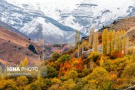
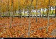
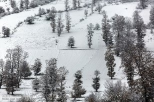
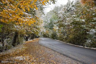
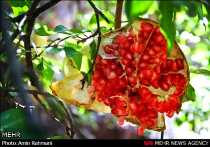
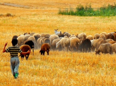
Sources: ISNA I, ISNA II, ISNA III, IRNA I, IRNA II, IRNA III, Tasnim News Agency (TNA) I, TNA II, TNA III, TNA IV, TNA V, TNA VI, TNA VII, TNA VIII, TNA IX, Azad News Agency, Mehr News Agency (MNA) I, MNA II, MNA III, MNA IV, MNA V, asangardi.com, Fars News Agency
Tag Archives: Autumn
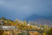
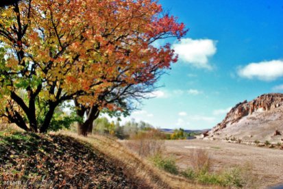
Photo Series: Autumn in Iran – Isfahan
Isfahan was once one of the largest cities in the world. It flourished from 1050 to 1722, particularly in the 16th century under the Safavid dynasty. Even today, the city retains much of its past glory. It is famous for its Persian–Islamic architecture, with many beautiful boulevards, covered bridges, palaces, mosques, and minarets. This led to the Persian proverb “Esfahān nesf-e- jahān ast” (Isfahan is half of the world).
The Naghsh-e Jahan Square in Isfahan is one of the largest city squares in the world and an outstanding example of Iranian and Islamic architecture. It has been designated by UNESCO as a World Heritage Site. The city also has a wide variety of historic monuments and is known for the paintings, history and architecture.
Photo gallery: Beautiful pictures of Isfahan in autumn
Today Isfahan is the capital of Isfahan Province and with a population of 1,755,382 inhabitants is also Iran’s third largest city after Tehran and Mashhad. The city is located 340 kilometres south of Tehran, in the lush plain of the Zayanderud River, at the foothills of the Zagros mountain range.
The nearest mountain is Mount Soffeh (Kuh-e Soffeh) which is situated just south of Isfahan, at 1,590 metres (5,217 ft) above sea level on the eastern side of the Zagros Mountains. Isfahan has an arid climate but despite its altitude, the city remains hot during the summer. However, with low humidity and moderate temperatures at night, the climate can be very pleasant.
Source: Wikipedia | Isfahan, ISNA I, ISNA II, ISNA III, Borna News I, Borna News II
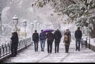
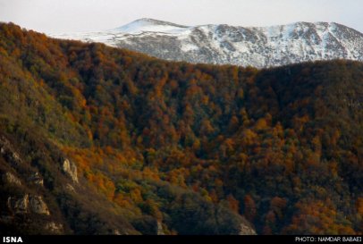
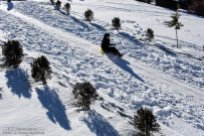
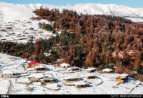
Autumn snow in northern and central Iran (Photos)
Photo Series: Autumn in Iran – Hamedan Province (Part 3)
Hamedan Province is one of the most ancient regions of Iran. The city of Hamedan laid on the Silk Road. The Province lies on the Zagros mountain range. Hamedan enjoys temperate warm summers and relatively cold winters.
According to local Jewish traditions, Hamedan is mentioned in the Book of Esther as the capital of Ancient Persia in the days of King Ahasuerus. It was then known as Shushan. The Tombs of Mordecai and Esther are located in modern-day Hamedan.
Related articles:
– The other Iran | Autumn in Iran
– The other Iran | Hamedan Province
Sources: Mehr News 1, ISNA 1, ISNA 2, Tasnim News, Wikipedia | Hamedan, Mehr News 2
Photo Series: Autumn in Iran – Arasbaran
Arasbaran is a mountainous area in the north of East Azerbaijan Province in northwest of Iran. This region is famous for the unique and intact nature. Since 1976 UNESCO has registered 72.460 hectares of Arasbaran as biosphere reserve. Enjoy the photo gallery!
Other Arasbaran photo galleries: The other Iran | Arasbaran
More information about Arasbaran: The other Iran | Spring in Arasbaran
Sources: ISNA, Mehr News Agency, Wikipedia | Arasbaran
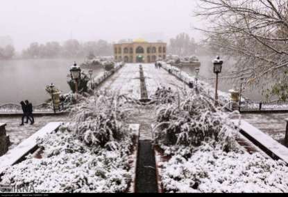
Photo series: Autumn in Iran – First snow in Tabriz
Tabriz, capital of East Azerbaijan Province, is one of the most populous cities in Iran. Located at 1,350 meters above sea level, it has cold winters and mild summers.
As one of the historical capitals of Iran, the city has a long and turbulent history. Its oldest civilization sites date back to 1,500 B.C. The transition of the different Iranian architecture styles is still visible on its buildings although repeated devastating earthquakes and several invasions have damaged many of its historical monuments. The Tabriz Historic Bazaar Complex was inscribed as a World Heritage Site in 2010.
Sources: IRNA, Young Journalists Club, Fars News Agency, Wikipedia | Tabriz
Photo Series: Autumn in Iran – Mashhad
Mashhad is the second most populous city in Iran and is the capital of Razavi Khorasan Province. It is located in the north east of the country close to the borders of Afghanistan and Turkmenistan. Its population is 3,131,586. It was a major oasis along the ancient Silk Road connecting with Merv in the East.
Mashhad is also known as the city of Ferdowsi, the Iranian poet of Shahnameh, which is considered to be the national epic of Iran. The city is also well-known and respected for housing the tomb of Imam Reza, the eighth Shia Imam.
Sources: Tasnim News, Wikipedia | Mashhad
Iran’s Kermanshah Province: Paveh – Pomegranate Harvest
Paveh, with a population of 19,800 inhabitants, is a city in Kermanshah Province, Iran. It is located in a sub-region along the Iran-Iraq border commonly referred to as Hewraman situated within the larger geographical region of Kurdistan. The city is considered by inhabitants of the region as the capital of the Hewraman. The inhabitants of Paveh are mostly Kurds that speak Auramani.
As a mountainous town, Paveh has cold winters and cool springs. The surrounding mountains are normally filled with fresh spring water from March to June. The town is also encircled with large fruit gardens which create beautiful sceneries during summers.
An old myth regarding the name of the city is that the Emperor Yazdgerd III sent his son named Pav to this area to renew his religious Zoroastrian faith. Both Persians and the local Kurdish inhabitants practiced Zoroastrianism during the Persian Empire’s Sasanian era from which this myth is derived.
Sources: ISNA, Wikipedia | Paweh
Photo series: Autumn in Iran – Danesfahan, Qazvin Province
Danesfahan is a city of around 9,000 inhabitants (2006) in Buin Zahra County, Qazvin Province, Iran. It is located west of Sagezabad and south of Esfarvarin. Historically, the city has been affected by earthquakes.
Photo gallery: Charming autumn nature in Danesfahan
Sources: Wikipedia | Danesfahan, Mehr News 1, Mehr News 2
Photo Series: Autumn in Iran – Gilan Province
Gilan Province lies along the Caspian Sea, bordering the Republic of Azerbaijan in the north, as well as Russia across the Caspian Sea. The climate is humid subtropical with the heaviest rainfall in Iran. Rasht, the capital of the province, is known within Iran as the “City of Rain”.
Large parts of the province are mountainous, green and forested. The coastal plain along the Caspian Sea is similar to that of Mazandaran, mainly used for rice paddies.
In May 1990 large parts of the province were destroyed by a huge earthquake, in which about 45,000 people died. Abbas Kiarostami made his films Life, and Nothing More… and Through the Olive Trees based upon this event.
Enjoy Gilan’s beauty in autumn:
Photo Series: Autumn in Iran – Mazandaran Province
Mazandaran is a Caspian province in the north of Iran. Located on the southern coast of the Caspian Sea, it is bordered clockwise by Russia (across the sea), Golestan, Semnan, Tehran, Alborz, Qazvin, and Gilan provinces. Sari is the largest city and the capital of Mazandaran province.
The diverse nature of the province features plains, prairies, forests and rainforest stretching from the sandy beaches of the Caspian Sea to the rugged and snowcapped Alborz sierra, including Mount Damavand, one of the highest peaks and volcanos in Asia.
Sources: ISNA 1, ISNA 2, Wikipedia | Mazandaran Province
Photo Series: Autumn in Iran – Asalem to Khalkhal road
Khalkhal is the capital of Khalkhal County, in Ardabil Province, Iran. Its population is 38.521 (2006). Asalem is a city in Talesh County, Gilan Province, Iran. Its population is 3.347 (2006).
The road from Asalem to Khalkhal is known for its beautiful landscapes.
Sources: Wikipedia | Asalem, Wikipedia | Khalkhal, Tasnim News Agency, Mehr News, JameJam
Photo series: Autumn in Iran – Snow in Tabriz
Tabriz, located at an elevation of 1,350 meters above sea level, is the capital of East Azerbaijan Province and the most populated city North-Western Iran. With cold winters and temperate summers, the city is considered a summer resort.
Photo gallery: Tabriz covered in early autumn snow
Related content: The other Iran | Tabriz, The other Iran | East Azerbaijan Province
Sources: JameJam Online, Tasnim News Agency, Mehr News 1, Mehr News 2, Wikipedia | Tabriz
Photo gallery: Ski season started at Tochal Ski Resort in Tehran, Iran
Tochal ski resort officially started this year’s autumn-winter season.
Tochal Complex, located on the northernmost part of Tehran, has been open to the public since 1978. The gondola lift, used for accessing ski resorts and other recreational centres on the mountain, has a length of 7500m. It starts at the Velenjak valley at an altitude of 1900m and ends at Station 7, at an altitude of 3740m, near the main ridge of Mount Tochal. The main ski slopes are located in Station 7 and due to its height they are covered with snow for more than 8 months of the year.
Tochal Mountain offers an unexpected array of outdoors activities –from hiking to skiing and is seen as one of the perfect places to escape the commotion of the city that lies below it; Tehran. There are various mountaineering routes across the rugged landscape, which cater to different levels of ability (and enthusiasm).
Sources: IRNA, ISNA, BORNA, Mehr News, Fars News, Young Journalists Club, Tehran Times (PDF), Wikipedia | Tochal Complex
Photo Series: Autumn in Iran – A rainy day in Tehran
Iran’s capital, Tehran, with a population of around 9 million in the city and 16 million in the wider metropolitan area, is the largest city and urban area of Iran. The semi-arid climate of the city is largely defined by its geographic location, with the towering Alborz Mountains to its north and the central desert to the south. The weather is mild in spring and autumn, hot and dry in summer, and cold in winter. Because the city is large with significant differences in elevation among various districts, the weather is often cooler in the hilly north than in the flat southern part of Tehran.
Photo gallery: A rainy autumn day in Tehran’s Mellat Park
Source: ISNA, Fars News, IRNA, Tasnim News, Wikipedia | Tehran
Photo Series: Autumn in Iran – Snowfall in Masal, Gilan
Masal, a county in the western part of Gilan Province, encompases the upper valley of the Shanderman River and the whole catchment basin of the Masal River (also called Ḵālekāi) until its arrival into the plain. The local population, 48,000 inhabitants in 2006, speaks Talysh, Gilaki and Persian. Masal and Bazar Jomeh are the only cities in the county.
The main agricultural production is rice, cultivated in the lower valleys and the edge of the plain, in small holdings. Of the three usual complementary resources of the plain (namely sericulture, tobacco, and tea), sericulture is the only one to have had a significant but highly variable role. The impact on this area of the crisis of silk production in the late 2000’s is uncertain. The other main activity and source of income is stock-breeding.
Unlike the valleys adjacent to the north or to the south, this area has no temporary bazaars on summer pastures because of the strong attraction and relative proximity of the Friday bazaar in Shanderman and Saturday bazaar in Masal. In both cases, this commercial activity has launched an urbanization process by gradually gathering services and resident population around the commercial core.
Sources: JameJamOnline, Instagram, Wikipedia | Masal County, Enciclopædia Iranica | Masal
Photo Series: Autumn in Iran – Along the Zayanderud, Chahar Mahal and Bakhtiari
Zayanderud (literally ‘river that gives life’) is the largest river in the central plateau of Iran. It starts in the Zagros mountain range in western Iran and runs 400km to the east before ending in the Gavkhouni Swamp, a seasonal salt lake, southeast of Isfahan city, in the central part of the country.
The Zayanderud Dam had its floodgates opened on Friday to supply the water required for farmers’ autumnal crop growing. The increase in discharge of the Zayanderud is making the landscape along the river even more enjoyable (see photos below).
Photos: The Zayanderud flowing through Chaharmahal and Bakhtiari on its way to the city of Isfahan
Sources: Tasnim News Agency, PressTV
Photo Series: Autumn in Iran – Snowfall in Talesh, Gilan
Talesh is a 200,000 inhabitants county in Gilan Province, Iran. Its capital, Hashtpar (also called Talesh), is situated 140 km north-west of Rasht, on the south-west coast of the Caspian Sea. The region, a mountainous area, outstands with its virgin ant intact nature.
Photos of the first snowfall in Talesh:
The Talysh are one of the oldest inhabitants of the western littoral Caspian Sea and are amongst the native inhabitants of today Iran and neighboring Azerbaijan.
Generally speaking, the land of Talesh has been divided in three regions: Gaskarat, Foumanat and Azerbaijan Taloshian. In Gaskarat, the majority of people speak Taleshi and/or Azeri, Farsi. In Foumanat, most speak Taleshi. Lastly, Talysh from neighboring Azerbaijan are often bilingual and trillingual, consisting of Taleshi, Azeri and Russian speakers. Taleshian people at present are mostly Sunni and Shia Muslims.
Sources: ISNA, Wikipedia | Talesh County
Photo Series: Autumn in Iran – Snowfall in Zanjan
Photos of autumn snow in Zanjan, Iran. Click on the pictures to start the gallery:
Source: Mehr News Agency
Photo Series: Autumn in Iran – Hamedan Province (Part 2)
Some beautiful pictures of Hamedan in autumn:
You can find another photo gallery of this beatiful region and some information about Hamedan in: The other Iran | Photo Series: Autumn in Iran – Hamedan Province (Part 1)
Source: IRNA
Iran’s Gilan Province: Anbu – Pomegranate Harvest
Anbu (also known as Anbuh-e Mashayekh) is a village in Talesh County, Gilan Province, Iran. At the 2006 census it had a population of 385 inhabitants.
Citizens of Anbu, a village in the south of Gilan, harvest pomegranates as fall arrives.
Iran’s Kurdistan Province: Zhivar – Pomegranate Harvest
Photo Series: Autumn in Iran – Gorgan’s Alang Darreh Park, Golestan Province
Gorgan is the capital of Golestan Province, Iran. It lies approximately 400km to the north east of Tehran and some 30km away from the Caspian Sea. It has a population of ca. 270.000 inhabitants. Some 150 km (93 mi) east of Gorgan is the Golestan National Park.
The city was named Hyrcania in ancient Greek records, the equivalent of the local name Varkâna “Land of the Wolves” in Old Persian. Although modern Gorgan is only a city and county sharing the same name, ancient Hyrcania was the name of a greater region on the southern shores of the Caspian Sea (encompassing all of the present day Golestan province, as well as some eastern parts of the Mazandaran province, and some southern parts of the present day Republic of Turkmenistan). Until 1937 the city used to be known as Astarabad.
Only 5km southwest from Gorgan, covering an area of approximately 185 hectares is Alangdareh Park. These beautiful autumn pictures were taken there.
In general, Golestan has a moderate and humid climate known as “the moderate Caspian climate.” There exist three different climates in the region: plain moderate, mountainous, and semi-arid. Gorgan valley has a semi-arid climate.
Gorgan (as well as the whole Golestan province) has a world-famous carpet and rug industry, made by Turkmen. The patterns of these carpets are derived from the ancient Persian city of Bukhara, which is now in Uzbekistan. Jajim carpets are also crafted in this province.
Sources: Wikipedia | Gorgan, Mehr News Agency | Photos
Photo Series: Autumn in Iran – Hamedan Province (Part 1)
Hamedan Province is one of the 31 provinces of Iran. It covers an area of 19,546 km² and has a population of over 1,82 million (2008). Its capital is Hamedan city. Hamedan province is one of the most ancient parts of Iran and its civilization. The city of Hamedan laid on the Silk Road.
The province lies in an elevated region with the ‘Alvand’ mountains running from the north west to the south west. These are part of the Zagros mountain range. Hamedan enjoys temperate warm summers and relatively cold winters.
According to local Jewish traditions, the City of Hamedan is mentioned in the Book of Esther as the capital of Ancient Persia in the days of King Ahasuerus. It was then known as Shushan. The Tombs of Mordecai and Esther are located in modern-day Hamedan.
Today’s Hamedan is what is left of Ecbatana, The Medes’ capital before they formed a union with the Persians. The poet Ferdowsi says that Ecbatana was built by King Jamshid. During the Parthian era Hamedan became the summer capital and residence of the Parthian rulers. After the Parthians, the Sassanids constructed their summer palaces in Hamedan as well.
Sources: ISNA, Mehr News Agency, Wikipedia | Hamedan Province
Photo Series: Autumn in Iran – Golestan Province
Golestan Province is one of the 31 provinces of Iran, located in the north-east of the country south of the Caspian Sea. It has a population of 1.6 million (2006) and an area of 20,380 km². Its capital is Gorgan. Present-day Gorgan was called Esterabad or Astarabad until 1937.
Golestan enjoys mild weather and a temperate climate most of the year. Geographically, it is divided into two sections: The plains, and the mountains of the Alborz range. In the eastern Alborz section, the direction of mountains faces northeast and gradually decreases in height. The highest point of the province is Shavar, with a height of 3,945 meters.
Photo Series: Autumn in Iran – Sabzevar, Razavi Khorasan Province
Sabzevar is a city of 200.000 inhabitants in Razavi Khorasan Province in northeastern Iran. It is the commercial center for an agricultural region producing grapes and raisins. There is some small-scale industry, for food processing, cooperware and electric motors. Through the old bazaar of Sabzevar fresh, dried, and preserved fruits and vegetables are exported.
In ancient times it was called Beihagh (Beyhaq). The history of Sabzevar goes back to the 1st millennium BC. Ancient remains include fire-temple ‘Azar Barzin’ which is still visible. Mil-e Khosrow Gerd (meaning “The brick tower of king Khosrau) is the highest brick tower in the city. This ancient brick tower dates back to 6th century and was part of city that no longer exists. This brick tower served as a travel guide for caravans traveling from Nishapur to Rey. Near Sabzevar are also remainings of yakhchals (ice houses or ice pits).
Sources: Wikipedia | Sabzevar, adayinlife.org, Mehr News


