Sources: IRNA 1, IRNA 2, ISNA 1, ISNA 2, ISNA 3, ISNA 4, Mehr News Agency (MNA 1), MNA 2, MNA 3, MNA 4, MNA 5, MNA 6, Tasnim News Agency (TNA) 1, TNA 2, TNA 3, TNA 4, TNA 5, Young Journalists Club
Tag Archives: Mazandaran Province
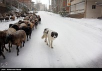
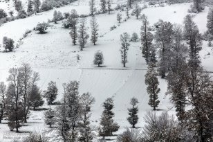
Photo series: Winter in Iran – Savadkuh County, Mazandaran
The Veresk Bridge and the Three Golden Lines, a railway spiral passing three times by the same area at different heights are located in Savadkuh County, Mazandaran Province. They are part of the Trans-Iranian Railway, a major railway building project that started in 1927 and completed in 1938. It links the capital Tehran with the Persian Gulf and Caspian Sea.
The Danish firm Kampsax began constructing Veresk Bridge in 1934. The structure stands at 110m height and has a 66m long arch. It connects two mountains in the Abbas Abad region.
The construction of this bridge included craftsmen of many nationalities. The name of the bridge is derived from the name of a Czechoslovakian technician whose name was hard to pronounce for Iranians. Near the bridge is a memorial for the workers who lost their life while building the bridge and its nearby tunnels. The Chief Engineer, Austrian Walter Aigner, following his wishes, is buried in the local cemetery of Veresk.
During World War II, it was known as the Pol-e-Piroozi, or the bridge of victory. During the course of the war, Reza Shah was asked by Hitler to blow up all tunnels and bridges, including the Veresk Bridge, on Iran’s railway lines in order to delay the transfer of goods and reinforcement troops to the north for the Russians. He furthermore promised to replace and reconstruct all of such demolished structures following the Germans’ victory in the war. Reza Shah rejected the request. Today trains connecting Tehran to Gorgan or Sari pass over this bridge an average of four times a day.
Sources: Wikipedia | Veresk Bridge, Borna News, highestbridges.com, fouman.com, Wikipedia | Trans-Iranian-Railway
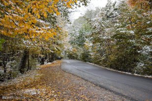
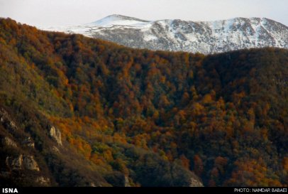
Photo Series: Autumn in Iran – Mazandaran Province
Mazandaran is a Caspian province in the north of Iran. Located on the southern coast of the Caspian Sea, it is bordered clockwise by Russia (across the sea), Golestan, Semnan, Tehran, Alborz, Qazvin, and Gilan provinces. Sari is the largest city and the capital of Mazandaran province.
The diverse nature of the province features plains, prairies, forests and rainforest stretching from the sandy beaches of the Caspian Sea to the rugged and snowcapped Alborz sierra, including Mount Damavand, one of the highest peaks and volcanos in Asia.
Sources: ISNA 1, ISNA 2, Wikipedia | Mazandaran Province
Badab-e Surt Spring, Iran – naturally formed staircase built over thousands of years
Badab-e Surt’s springs are two distinct mineral springs with different natural characteristics, located at 1,840 metres (6,040 ft) above sea level in Mazandaran Province in northern Iran
Over the course of thousands of years the water from these two springs emanating from the mountain range have combined and resulted in a number of orange-, red- and yellow-colored pools shaped as a naturally formed staircase.
Other interesting photos of Iran: The other Iran | Photos
Sources: Wikipedia | Badab-e Surt, Bing (pictures)
Iran’s Mazandaran Province: A glimpse at its beautiful and diverse nature (Photos)
Mazandaran Province is located in the north of Iran, on the southern coast of the Caspian Sea, with Sari as its provincial capital.
The diverse nature of the province features plains, prairies, forests and rainforest stretching from the sandy beaches of the Caspian Sea to the rugged and snowcapped Alborz mountain range, including Mount Damavand, one of the highest peaks and volcanos in Asia. The Alborz Mountain Range surrounds the coastal strip and plains of the Caspian Sea like a huge barrier.
The province enjoys a moderate, subtropical climate with an average temperature of 25 °C in summer and about 8 °C in winter. Although snow may fall heavily in the mountains in winter, it rarely falls at sea level.
 This region has a variety of climates, including the mild and humid climate of Caspian shoreline and the moderate and cold climate of mountainous regions. In the 1,500- to 3,000-meter altitudes, snow covers parts of the province even up to the middle of the warm season. In fact, snow can be observed in this region even in the warmest months of the year, which lends a touch of beauty to this region.
Human habitation in the area dates back at least 75,000 years. Recent excavations in Goher Tippe provide proof that the region has been urbanized for more than 5,000 years, and the area is considered one of the most important historical sites of Iran. Mazandaran was a part of the ancient Persian province of Hyrcania.
The population is overwhelmingly Mazandarani, with a minority of Azerbaijanis, Georgians, Armenians, Circassians, Turkmen and others. Mazandaran is a center for Iranian culture and has produced a number of famous poets. The people are largely secular, and consequently women have had greater social freedom and independence than their Persian cousins. The cuisine of the province is very rich in seafood due to its location by the Caspian Sea, and rice is present in virtually every meal. Indeed, the rest of Iran was introduced to rice through Gilan and Mazandaran.
Sources: Wikipedia | Mazandaran, Mehr News | Photos 1, Mehr | Photos 2, WikiCommons | Mazandaran, Fars News | Photos, Tasnim News | Photos, Iran Chamber Society | Mazandaran
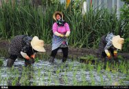
Rice fields in Iran (Photos)
Iran is a vast country, covering 1,648,000 km2 (164.8 million ha). Its topography is dominated by two mountain ranges – Alborz and Zagros – while two great deserts extend over much of the central region, leaving about 20 million ha for crop production. On account of the highly diverse climatic and soil conditions, only 12.5 million ha are cultivated annually with a wide range of food crops. Wheat, rice and barley are the most important cereals cultivated.
Rice is the staple food in Iran, with the quality of cooked rice outweighing all other considerations for Iranian consumers. The total area under rice is more than 600 thousand ha and rice is now grown in varying degrees in nearly all provinces of Iran. However, more than 80 percent of rice area is distributed in the two northern provinces of Mazandaran and Gilan.


Iran’s rice production in 2011 was 2.4 million tons, which increased from a total of 2.3 million tons in the previous year. Iran has 3,800 rice milling units (2009). Iran has imported about 1.4 million tons of rice from UAE, Pakistan and Uruguay worth $800 million in 2009. Iran’s rice imports drop by 40% in 2010. The average per capita consumption of rice in Iran is 45.5 kg, which makes Iranians the 13th biggest rice consumers.
The photos were taken in different Iranian provinces: Qazvin, Gilan, Kurdistan, North Khorasan, Fars and Kohgiluyeh and Boyer-Ahmad.
Sources: Food and Agriculture Organization of the United Nations (FAO) | The rice situation in Iran by N. Shobha Rani, Wikipedia | Agriculture in Iran, Encyclopaedia Iranica | Berenj “rice”, Mehr News Agency | Photos, MNA | Photos, Tasnim News Agency | Photos 1, Tasnim | Photos 2, Tasnim | Photos 3, Tasnim | Photos 4, IRNA | Photos, ISNA | Photos 1, ISNA | Photos 2
Photos: Lar National Park in Tehran and Mazandaran Provinces, Iran
Lar National Park (in Persian: Park-e Melli-e Lar) is a protected area in Iran on the foot of Mount Damavand, straddling the provinces of Mazandaran and Tehran. The Lar Dam is located in the park, and is a major tourist attraction because it is just 70 kilometers northeast of Tehran. The park covers around 30,000 hectares. It has been a national park since 1976 and a protected area since 1982 by the Iran Department of Environment. Since 1991 hunting has been prohibited.
Sources: Wikipedia | Lar National Park, Tasnim News Agency | Photos
Photos: Eshkevarat in Gilan and Mazandaran Provinces, Iran
Eskevarat is a region on the Alborz that extends through Gilan and Mazandaran Provinces.
The rural district (dehestan) Eshkevar-e Sofla lies in Rudsar County, Gilan Province. It has 46 villages and a population of 4,842 inhabitants (2006). Eshkevar is the name of a rural district with 11 villages in Ramsar County, Mazandaran Province. At the 2006 census, its population was 1,600.
Sources: Mehr News Agency | Photos 1, Mehr News Agency | Photos 2, Tishineh | Eshkevarat (Persian), Wikipedia | Eshkevarat (Persian), Wikipedia | Eshkevar-e Sofla, Wikipedia | Eshkevar
Photos: Swans arrive from Siberia in Sorkhroud, northern Iran
In the recent years, during winter about 5000 swans migrate from Siberia to the wetlands of the Caspian town of Sorkhroud in northern Iran. The swans return back to Siberia after the the cold season ends. The swans bring life and beauty to the wetlands and attract many visitors. Environmental activists are also busy trying to educate the public to be a good host to their guests!
More beautiful pictures at: Payvand News
The Caspian Sea, the worlds largest landlocked lake
“Caspian Sea, the largest landlocked lake in the world, is located in northern Iran. The Iranian Caspian coast including the three littoral provinces of Gilan, Golestan and Mazandaran, with its thick forests and large-scale rice paddies presents a striking contrast to the dry inner plateau of Iran.
A four-hour drive from Tehran, the Caspian is Iran’s Riviera, with a narrow plain of paddyfields and orchards separating the sea from forested mountains where bears and leopards roam around ruined Mongol castles.”
Also: Wikipedia | Caspian Sea


