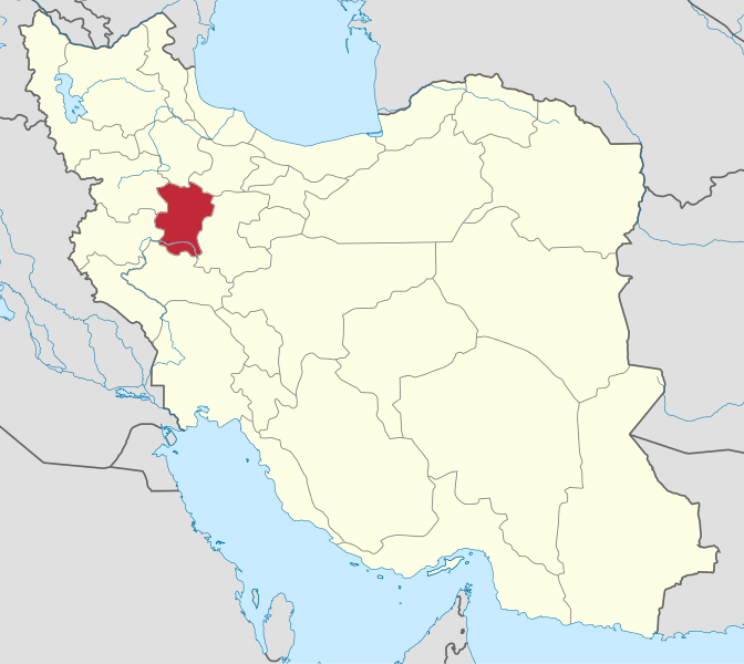
Kordkuy’s County protected area, Khalid Nabi Cemetery and Gonbad-e Qabus Tower are among the attractions that helped Golestan’s tourism growth.
Jahan Nama is a village with 99 inhabitants (2006) in Chaharkuh Rural District, Golestan Province, Iran. This area is situated in the southern heights of Gorgan and the southeast of Kord Kooy (the Mountain of Kurd). In 1973 30,650 ha in this region were declared protected area.
Wild goat, wild sheep, vension, panther, wolf, beer, owl, eagle, shoulca, weasel, and porcupine belong to the wildlife of this region and some of its plants are: Rosh, Azad, Barberry, Sorkhdar, Kolahe Mir Hassan, Bolandmaza Namdar, Borage Cowslipe, Ras, and Darmaneh. Several studies in the area found 1350 specimens, which included a total number of 607 vascular plant species.
The most important rivers and springs are: Sefid Rood, Tarkan, Mahzi, Chaar Baq, Ziyarat, Marsang, Sbumargah, Shahpasand, Haji Abad, Gachian, Mord Cheshmeh, Vara, Khosh Dasti, Kalichal, Qormehtou, Pazeebon.
Gonbad-e Qabus Tower is a monument in Gonbad-e Qabus, Iran, and a UNESCO World Heritage Site since 2012. The Tower in the central part of the city reaches 72 metres (236 ft) (including the height of the platform).
The baked-brick-built tower is an enormous decagon building with a conic roof, which forms the golden ratio Phi, that equals 1.618. The interiors contain the earliest examples of Muqarnas decorative styles. The decagon with its 3 meter-thick wall, divided into 10 sides, has a diameter of 17 m . The Tower was built on such a scientific and architectural design that at the front of the Tower, at an external circle, one can hear one’s echo.
The tower was built in 1006 AD on the orders of the Ziyarid Amir Shams ol-Ma’āli Qabus ibn Wushmgir. It is located 3 km north of the ancient city of Jorjan, from where the Ziyarid dynasty ruled. The tower is over 1000 years old.
Khalid Nabi Cemetery (in Persian: cemetery of the prophet Khaled) is a cemetery in northeastern Iran’s Golestan province, roughly 65km northeast of Gonbad-e Kavous, in the Gokcheh Dagh hills of Turkmen Sahra. It is mainly situated on a mountain ridge about 1 km distance from the mausoleum called “Khaled Nabi” who according to oral tradition of the Yomut Turkomans was a pre-Islamic prophet (payghambar).
The cemetery was visited in 1979 and 1980 by the archeologist David Stronach . He found over 600 standing stones which are spread out in several locations. About half of them are on the ridge which he calls ” High Plateau ” South and south-east of that are small groups of stones on several other ridges and hillocks. At some distance there is another group of perhaps 150 stones which are distributed over a wide area on the south side of the mountain. Stronach noted two types of gravestones on the site. In both he saw “highly stylized representations of people.”
In popular media the stones are often described as examples of phallic architecture and a major tourist attraction. Touristic visitors often have perceived the cylindrical shafts with the thicker top as depictions of male phalli. This gave rise to popular guesses about preislamic fertility cults as background to such perceived depictions. Consequently the rounded, second type of stones were attributed to female forms and graves. Such descriptions have added to the popularity of the site for visitors from distant parts of Iran. The cemetery is now a national heritage site protected by the Iranian government.
Sources: Mehr News Agency | Photos, Wikipedia | Khalid Nabi Cemetery, Wikipedia | Gonbad-e Qabus Tower, Wikipedia | Jahan Nama


 in Shahdad Desert")
 in Shahdad Desert")
 in Shahdad Desert")
 in Shahdad Desert")
 in Shahdad Desert")
 in Shahdad Desert")
 in Shahdad Desert")
 in Shahdad Desert")
 in Shahdad Desert")
 in Shahdad Desert")
 in Shahdad Desert")
 in Shahdad Desert")
 in Shahdad Desert")
 in Shahdad Desert")


, Hormozgan Province, Iran")
, Hormozgan Province, Iran")
, Hormozgan Province, Iran")
, Hormozgan Province, Iran")
, Hormozgan Province, Iran")
, Hormozgan Province, Iran")
, Hormozgan Province, Iran")
, Hormozgan Province, Iran")
, Hormozgan Province, Iran")
, Hormozgan Province, Iran")
, Hormozgan Province, Iran")
, Hormozgan Province, Iran")
, Hormozgan Province, Iran")
, Hormozgan Province, Iran")
, Hormozgan Province, Iran")
, Hormozgan Province, Iran")
, Hormozgan Province, Iran")
, Hormozgan Province, Iran")
, Hormozgan Province, Iran")
, Hormozgan Province, Iran")
, Hormozgan Province, Iran")
, Hormozgan Province, Iran")
, Hormozgan Province, Iran")
, Hormozgan Province, Iran")
, Hormozgan Province, Iran")
, Hormozgan Province, Iran")
, Hormozgan Province, Iran")
, Hormozgan Province, Iran")
, Hormozgan Province, Iran")


 1")
 2")
 3")
 4")
 5")
 2")
 1")
 6")
 7")
 - 15")
 - 01")
 - 02")
 - 13")
 - 05")
 - 08")
 - 06")
 - 03")
 - 04")
 - 07")
 - 09")
 - 10")
 - 11")
 - 12")
 - 14")
 - 16")
 in spring 03")
 in spring 05")
 in spring 04")
 in spring 02")
 in spring 10")
 in spring 07")
 in spring 08")
 in spring 06")
 in spring 01")
 in spring 00")
 in spring 12")
 in spring 13")
 in spring 14")
 in spring 29")
 in spring 30")
 in spring 34")
 in spring 36")


 09")
 10")


")


")

")

")


 to Khalkhal (Ardabil) 38 - (Photo by Ali Memari - Panoramio User 4500840)")
 to Khalkhal (Ardabil) 67 - (Photo by Peyman Azimi - Panoramio User 5065923)")
 to Khalkhal (Ardabil) 60 - (Photo credit alireza.younnesi - Instagram)")
 to Khalkhal (Ardabil) 22a - (Photo by Ali Memari - Panoramio User 4500840)")
 to Khalkhal (Ardabil) 07 -")
 to Khalkhal (Ardabil) 23 - (Photo by Ali Memari - Panoramio User 4500840)")
 to Khalkhal (Ardabil) 63 - (Photo credit nima_ki - Instagram)")
 to Khalkhal (Ardabil) 25 - (Photo by Ali Memari - Panoramio User 4500840)")
 to Khalkhal (Ardabil) 15 - (Photo by Ali Memari - Panoramio User 4500840)")
 to Khalkhal (Ardabil) 05 -")
 to Khalkhal (Ardabil) 29 - (Photo by Ali Memari - Panoramio User 4500840)")
 to Khalkhal (Ardabil) 39 - (Photo by Ali Memari - Panoramio User 4500840)")
 to Khalkhal (Ardabil) 21a - (Photo by Ali Memari - Panoramio User 4500840)")
 to Khalkhal (Ardabil) 18 - (Photo by Ali Memari - Panoramio User 4500840)")
 to Khalkhal (Ardabil) 31 - (Photo by Ali Memari - Panoramio User 4500840)")


 1")
 2")
 3")
 5")


 13")
 20")
 31")
 22")
 32")
 36")
 33")
 23")
 14")
 21")


 Hassani")


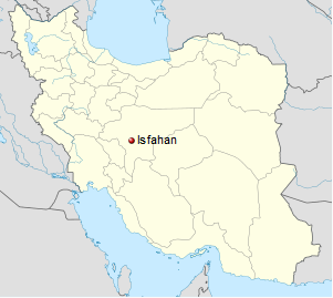
 The Zayanderud (Zayandeh River) is the largest river in the central plateau of Iran. It crosses directly through the city of Isfahan. In 2010, the river dried out completely after several years of draught. Today the river flows with water once again, however the city continues to close and open the dam throughout the year depending on water shortages throughout the districts. The water that forms the river originates from the inside of the Zagros Mountains and flows 400 kilometers. The 400 km of river is spanned by may historical bridges that were built in the Safavid era. The Zayanderud is the reason for the prosperity of the central Iranian provinces of Isfahan and Yazd. Two of the most famous bridges on the Zayanderud are the Siosepol (33 Bridge) and Pol-e Khaju (Khaju Bridge).
 Women wearing head-to-toe hijab are having kayaking practice on the Zayanderud. They are padding upstream while…
")
")
")
")
")
")
")
")
")
")
")
")
")
")
")
")
")
")


 The Aspakhu (Espakhou) Fire Temple is one of the oldest structures in Iran’s
  Fire Temple 09")
 Fire Temple 01")
 Fire Temple 05")
 Fire Temple 11")
 Fire Temple 02")
 Fire Temple 08")
 Fire Temple 13")
 Fire Temple 15")


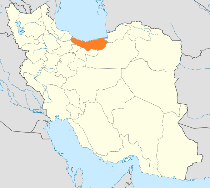
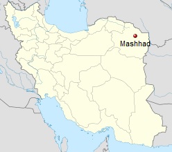 Mashhad (Persian: مشهد) with 3.150.000 inhabitants is the second most populous city in Iran and capital of Razavi Khorasan Province. It is located in the northeast of the country, close to the borders of Turkmenistan and Afghanistan. It was a major oasis along the ancient Silk Road connecting with Merv in the East.