Sources: ISNA I, ISNA II, ISNA III, IRNA I, IRNA II, IRNA III, Tasnim News Agency (TNA) I, TNA II, TNA III, TNA IV, TNA V, TNA VI, TNA VII, TNA VIII, TNA IX, Azad News Agency, Mehr News Agency (MNA) I, MNA II, MNA III, MNA IV, MNA V, asangardi.com, Fars News Agency
Tag Archives: Nature
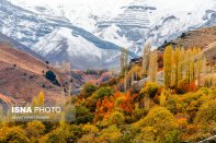
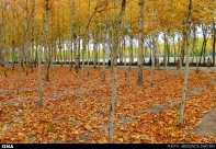
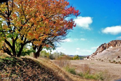
Photo Series: Autumn in Iran – Isfahan
Isfahan was once one of the largest cities in the world. It flourished from 1050 to 1722, particularly in the 16th century under the Safavid dynasty. Even today, the city retains much of its past glory. It is famous for its Persian–Islamic architecture, with many beautiful boulevards, covered bridges, palaces, mosques, and minarets. This led to the Persian proverb “Esfahān nesf-e- jahān ast” (Isfahan is half of the world).
The Naghsh-e Jahan Square in Isfahan is one of the largest city squares in the world and an outstanding example of Iranian and Islamic architecture. It has been designated by UNESCO as a World Heritage Site. The city also has a wide variety of historic monuments and is known for the paintings, history and architecture.
Photo gallery: Beautiful pictures of Isfahan in autumn
Today Isfahan is the capital of Isfahan Province and with a population of 1,755,382 inhabitants is also Iran’s third largest city after Tehran and Mashhad. The city is located 340 kilometres south of Tehran, in the lush plain of the Zayanderud River, at the foothills of the Zagros mountain range.
The nearest mountain is Mount Soffeh (Kuh-e Soffeh) which is situated just south of Isfahan, at 1,590 metres (5,217 ft) above sea level on the eastern side of the Zagros Mountains. Isfahan has an arid climate but despite its altitude, the city remains hot during the summer. However, with low humidity and moderate temperatures at night, the climate can be very pleasant.
Source: Wikipedia | Isfahan, ISNA I, ISNA II, ISNA III, Borna News I, Borna News II
Iran’s Fars Province: Wildlife refuge at Neyriz Lakes & Kamjan Marshes (Photos)
The site lies in the eastern Zagros Mountains, 50-160 km east of Shiraz, and includes two very large salt-lakes -Tashk and Bakhtegan- and a large area of permanent freshwater marshes and seasonally flooded plains along the lower Kur river to the west (Kamjan Marshes). The two lakes are normally separated by narrow strips of land but may be joined during very wet winters to form a single expanse of water covering up to 136.500 ha.
Supporting more than 20.000 waterfowl, up to 50.000 flamingos and other species (e.g. ducks, geese, swans and cranes), the lakes are extremely important for breeding of a wide variety of species.
Kamjan Marshes formerly comprised ca. 10.000 ha of permanent and seasonal freshwater marshes. Although the marshes have been extensively modified by the drainage canals, 5.250 ha of wetland remains, including expanses of wet mudflats. Some irrigation canals are already silting up, and parts of the drained land are reverting to marsh. In addition, new marshes have developed at the mouths of the three main drainage canals where they enter the western ends of Lake Tashk and Lake Bakhtegan.
The two lakes, their delta and spring-fed marshes are designated as Wetlands of International Importance by the Ramsar Convention on Wetlands. The Ramsar Convention on Wetlands is an inter-governmental treaty established in 1971, establishing a framework for the stewardship and preservation of wetlands.
Sources: birdlife.org, ramsar.org, Wikipedia | Bakhtegan Lake, irandeserts.org (in Persian), MEHR News Agency, Tasnim News Agency I, Tasnim News Agency II, tishineh.com
Iran’s Kerman Province: Beautiful yardang landscape near Shahdad (Photos)
Shahdad Desert, on the western edge of Lut Desert, is home to unique natural structures called kalut (sand castles) by locals. The area is regarded as an archeological site of Kerman Province with graveyards, forts, and caravanserais which date back to the fourth millennium B.C.
The Lut Desert is a large salt desert located in the provinces of Kerman and Sistan and Baluchestan, Iran. It was inscribed on UNESCO’s World Heritage List in 2016. The hottest part of Dasht-e Lut is Gandom Beryan, an approximately 480km² (190 sq mi) large plateau covered in dark lava, 80 km north of Shahdad city. According to a local legend, Gandom Beryan (toasted wheat) originates from an accident where a load of wheat was left in the desert which was then scorched by the heat in a few days. The surface of its sand has been measured at temperatures as high as 70 °C (159 °F), making it one of the world’s driest and hottest places.
These impressive formations which are scattered over 11.000km² across the desert are called yardangs. They form by erosion in environments where water is scarce and the prevailing winds are strong, uni-directional, and carry an abrasive sediment load.
Sources: Wikipedia | Lut Desert, Wikipedia | Yardang, Iran Front Page, BORNA News, wikimedia.org, irandeserts.com (in Persian), untoldiran.com, Mehr News Agency, 500px.com, panoramio.com
Iran’s National Botanical Garden in Tehran (Photos)
Founded in 1968, the garden extends over an area of about 150ha (370ac) and is planned to be the main center for horticulture and plant taxonomy in Iran.
A herbarium of Iranian plants is gradually being built up and now consists of some 160,000 species. It also contains gardens of non-Iranian plants, an arboretum, six lakes, hills (to represent the Alborz and Zagros mountains), a rock garden, a waterfall, a wetland, a river about 1 km long, systematic area, fruit garden, picnic area with some pavilions, desert plants areas, a salt lake and a wadi (a dry, ephemeral, riverbed that contains water only during times of heavy rain). The botanical and horticultural library has more than 11.000 volumes.
The area, located at 1320m altitude by the freeway between Tehran and Karaj, is flat and slopes gently to the south. The Albourz Mountains forms the background. The climate is dry with an average annual precipitation of about 240 mm falling between November and May. Temperature reaches as much as 42–43ºC during July and August. During winter the temperature may fall to –10ºC or lower. The natural vegetation of the area is dry Artemisia Siberia steppe.
Sources: Research Institute of Forests and Rangelands, Wikipedia, instagram @nbgiran, Mehr News Agency (MNA) 1, MNA 2, MNA 3, Tehran Picture, tishineh.com, netbaran.com, behtarynha.com
Photos: Compilation of 2016’s supermoons in Iran
A supermoon is the coincidence of a full moon or a new moon with the closest approach the Moon makes to the Earth on its elliptical orbit, resulting in the largest apparent size of the lunar disk as seen from Earth.
In 2016 there were three consecutive supermoons (in October, November and December). The moon on November 14 was the closest supermoon since January 26, 1948.
Sources: Wikipedia | Supermoon, ANA, IRNA, ISNA, Mehr News Agency, Tasnim News Agency 1, Tasnim 2, Young Journalists Club
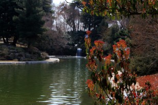
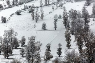
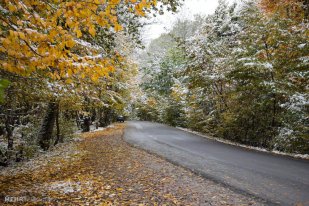
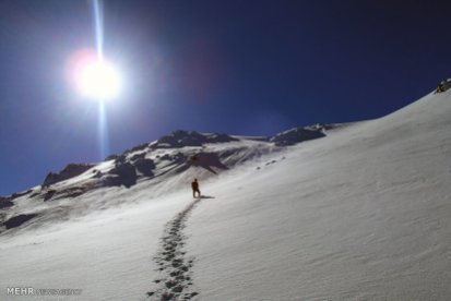
Autumn snow in northern and central Iran (Photos)
Photo Series: Autumn in Iran – Hamedan Province (Part 3)
Hamedan Province is one of the most ancient regions of Iran. The city of Hamedan laid on the Silk Road. The Province lies on the Zagros mountain range. Hamedan enjoys temperate warm summers and relatively cold winters.
According to local Jewish traditions, Hamedan is mentioned in the Book of Esther as the capital of Ancient Persia in the days of King Ahasuerus. It was then known as Shushan. The Tombs of Mordecai and Esther are located in modern-day Hamedan.
Related articles:
– The other Iran | Autumn in Iran
– The other Iran | Hamedan Province
Sources: Mehr News 1, ISNA 1, ISNA 2, Tasnim News, Wikipedia | Hamedan, Mehr News 2
Photo Series: Autumn in Iran – Arasbaran
Arasbaran is a mountainous area in the north of East Azerbaijan Province in northwest of Iran. This region is famous for the unique and intact nature. Since 1976 UNESCO has registered 72.460 hectares of Arasbaran as biosphere reserve. Enjoy the photo gallery!
Other Arasbaran photo galleries: The other Iran | Arasbaran
More information about Arasbaran: The other Iran | Spring in Arasbaran
Sources: ISNA, Mehr News Agency, Wikipedia | Arasbaran
Photo Series: Autumn in Iran – Mashhad
Mashhad is the second most populous city in Iran and is the capital of Razavi Khorasan Province. It is located in the north east of the country close to the borders of Afghanistan and Turkmenistan. Its population is 3,131,586. It was a major oasis along the ancient Silk Road connecting with Merv in the East.
Mashhad is also known as the city of Ferdowsi, the Iranian poet of Shahnameh, which is considered to be the national epic of Iran. The city is also well-known and respected for housing the tomb of Imam Reza, the eighth Shia Imam.
Sources: Tasnim News, Wikipedia | Mashhad
Iran’s West Azerbaijan Province: Shalmash Falls (Photos)
Shalmash Falls is a cluster of three waterfalls, each of them about 10m high, along a branch of the Little Zab River, situated on the outskirts of the village of Sardasht, West Azerbaijan Province, Iran.
The falls lie in a beautiful valley, surrounded by scattered forests. There is a staircased viewing platform to ease the access to the falls but a good hike deep into the valley would be necessary to go near the other two falls.
Sources: Wikipedia | Shalmash Falls, Iran Daily, IRNA 1, IRNA 2, tishineh.com
Watching Perseids in Iran (Photos)
The Perseids is a prolific meteor shower visible from mid-July each year, that stretches along the orbit of the comet Swift–Tuttle. The cloud consists of particles ejected by the comet as it travels on its 133-year orbit. The meteors were named Perseids because the point from which they appear to come, called the radiant, lies in the constellation Perseus.
Although they can be seen all across the sky, they are primarily visible in the Northern Hemisphere. The peak in activity is between August 9th to 14th. During the peak, the rate of meteors reaches 60 or more per hour. Most Perseids burn up in the atmosphere while at heights above 80km.
The earliest record of Perseid activity comes from the Chinese annals, where it is said that in 36 AD “more than 100 meteors flew thither in the morning.” Numerous references appear in Chinese, Japanese and Korean records throughout the 8th, 9th, 10th and 11th centuries.
Perseids seen in Darbid and Khoravand. Darbid is a village in Yazd Province, 40km from the city of Yazd. Khoravand is a village in Markazi Province, 70km from Arak.
In Europe, the first known observation is from the year 811 and the first known written record is from “Introduction a la Philosophie naturelle” by Dutch scientist Pieter van Musschenbroek in 1762, where he states that the increased August meteor activity is a recurring event. In 1835, Belgian astronomer Adolphe Quetelet identified the shower as emanating from the constellation Perseus. In 1866, after the perihelion passage of Swift-Tuttle in 1862, the Italian astronomer Giovanni Virginio Schiaparelli discovered the link between meteor showers and comets.
The Perseids is the most famous of all meteor showers. Due to its summertime appearance, it tends to provide the majority of meteors seen by non-astronomy enthusiasts.
Sources: Wikipedia | Perseids, meteorshowersonline.com, Tasnim News Agency, Borna News, Wikipedia | Khoravand, Wikipedia | Darbid
Iran’s Kermanshah Province: Paveh – Pomegranate Harvest
Paveh, with a population of 19,800 inhabitants, is a city in Kermanshah Province, Iran. It is located in a sub-region along the Iran-Iraq border commonly referred to as Hewraman situated within the larger geographical region of Kurdistan. The city is considered by inhabitants of the region as the capital of the Hewraman. The inhabitants of Paveh are mostly Kurds that speak Auramani.
As a mountainous town, Paveh has cold winters and cool springs. The surrounding mountains are normally filled with fresh spring water from March to June. The town is also encircled with large fruit gardens which create beautiful sceneries during summers.
An old myth regarding the name of the city is that the Emperor Yazdgerd III sent his son named Pav to this area to renew his religious Zoroastrian faith. Both Persians and the local Kurdish inhabitants practiced Zoroastrianism during the Persian Empire’s Sasanian era from which this myth is derived.
Sources: ISNA, Wikipedia | Paweh
Jangal-e Abr: Beautiful cloud forest in northern Iran (Photos)
Jangal-e Abr (Cloud Forest or Cloud Jungle) is one of the oldest and most beautiful forests in Iran. It is located on the eastern part of Alborz mountains, on the border between the provinces of Semnan and Golestan, 45km north east of Shahrud.
Sprawling on an area of 35,000 hectares, the Cloud Forest is a remnant of the ancient Caspian and Hyrcanian forests, encircling the northern slopes of the Alborz Mountains like a belt, covering the southern coasts of the Caspian Sea. Inside the thick woods, it is hard to imagine that the forest is located in the semi-arid province of Semnan, close to the Central Desert and Khar-Turan National Park.
When the temperature falls, two or three hours before sunset, clouds rush into the forest. They are so thick that you may not see an arm lenght in front of you. Above them Ghale Maran, a peak of high altitude, seems to be floating on the sea of clouds. It is said that there was ancient castle located on top of this mountain, south of Ramian. After a while into the night, the clouds usually scatter away, letting a clear view of the surrounding valleys, if the moon is up.
Sources: ISNA 1, ISNA 2, irpedia.com, financialtribune.com, tishineh.com, iranlandmark.ir, instagram @chamgir, instagram @yasin_0500, instagram @sshnzk, instagram @arsalanpartovi, anobanini.com, Wikipedia | Jangal-e Abr (in Persian)
Hiking in Iran: Landi waterfall in Chahar Mahal and Bakhtiari Province (Photos)
Landi is a 700-inhabitants village surrounded by beautiful nature in Ardal County, Chaharmahal and Bakhtiari Province, Iran. A one night hiking trip away from a waterfall surrounded by pristine nature.
Photos: Road and hiking trip – From Tehran to Landi Waterfall
Sources: Mehr News, Wikipedia | Landi Village, anobanini.com 1, anobanini.com 2 (in Persian)
Photo Series: Spring in Iran – Ardabil Province
The province of Ardabil is located in the north-west of Iran, bordering the Republic of Azerbaijan and the provinces of East Azarbaijan, Zanjan and Gilan. The Talesh mountain range on the east separates Ardabil from Gilan. The majority of its population are Azeris.
The origins of the city Ardabil go back 4000 to 6000 years, but its golden age was in the Safavid period. The name of Ardabil came from a Zoroastrian name of “Artavil” (mentioned in Avesta) which means a holy place. Meshgin Shahr, called “Khiav”, “Orami”, and “Varavi” in the past, is the closest city to the Sabalan mountains.
Sabaland, an inactive volcano in the Alborz mountains, is Ardabil’s most famous natural region but the province offers many other beautiful natural landscapes, mineral and hot springs (Sareyn, Khalkhal, Sardabeh, Booshli) and lakes (Neor, Shoorabil, Shoorgel, Noushahr, Alooche).
The weather in the province varies drastically. The city of Ardabil has very cold winters (-23°C) and very pleasant summers. Bilasuar and Parsabad have hot summers and warm winters. But generally this province is considered the coldest province in Iran though large parts of the province are green and forested.
Other nature posts: The other Iran | Nature
Sources: Iran Chamber Society, Wikipedia | Ardabil Province, IRNA 1, IRNA 2, Tasnim News Agency (TNA) 1, TNA 2, ISNA
Photo Series: Spring in Iran – North Khorasan Province
North Khorasan Province, located in northeastern Iran with Bojnord as its capital, is one of the most multicultural territories in the country: Kurdish speakers make a 46.1% of the population, followed by Persian speakers (27.8%), Khorasani Turks (20.6%), Turkmens (3.3%) and other Iranians (2.2%).
Photos: Early spring days across North Khorasan Province (Borna)
Sources: Wikipedia | North Khorasan, Borna News Agency
Iran’s Alborz Province: Dizin Ski Resort hosts snowboard competition (Photos)
Iran hosted earlier this month a snowboard and freestyle ski competition event in Dizin Ski Resort, north of the capital Tehran. Eight female and twenty eight male athletes competed alongside, defying the unexpected, unfavorable weather conditions at the beginning of the tournament.
Dizin, established in 1969, is one of the larger Iranian ski resorts in the Alborz mountain range, 120km from Tehran by car. The ski season in Dizin lasts from December to May, because of the resort’s high altitude.
Related article: The other Iran | Dizin Ski Resort
Sources: IRNA, Mehr News Agency (MNA) 1, MNA 2, Tasnim News Agency, Fars News Agency, Young Journalists Club, ISNA, PressTV
Photos: Sizdah bedar ( Nature day ) in Iran
Sizdah Be-dar, literally “thirteenth in outdoors”, is an Iranian festival, and part of the Nowruz celebration rituals, held annually on the thirteenth day of the first month of the Iranian calendar (Farvardin). It is celebrated by leaving the house to spend the day outdoors, picnicking and enjoying nature. Thus this festival is also known as “Nature Day”.
A ritual performed at the end of the picnic is to throw away the sabzeh (greenery on the haft-sin table) part of the traditional table setting for Nowruz in Iran. Doruq-e Sizdah, the Iranian version of the prank-playing April Fools’ Day is also celebrated on this day.
Sizdah Bedar is customary to Iraq, Armenia, Azerbaijan and some parts of Central Asia. In cities with large populations of Iranians, like Los Angeles, it is common to see families celebrating Sizdah Bedar across the city.
Related article: The other Iran | Sizdah Bedar 2015
Photos: Sizdah Bedar 2016 in Iran – Picnicking outdoors on a sunny, rainy and even a snowy day!
Sources: Wikipedia | Sizdah Be-dar, kish.ir 1, kish.ir 2, IRNA 1, IRNA 2, IRNA 3, IRNA 4, ISNA 1, ISNA 2, ISNA 3, ISNA 4, ISNA 5, ISCA News, Mehr News Agency (MNA) 1, MNA 2, MNA 3, MNA 4, MNA 5, Fars News Agency, Tehran Picture Agency (TPA) 1, TPA 2, TPA 3, TPA 4, TPA 5, TPA 6, Borna News 1, Borna News 2, Borna News 3, Borna News 4, Borna News 5, Borna News 6, Tasnim News Agency (TNA) 1, TNA 2, TNA 3, TNA 4, JameJam Online, Young Journalists Club (YJC) 1, YJC 2, Azad News Agency (ANA) 1, ANA 2
Photo Series: Spring in Iran – Marivan, Kurdistan Province
Marivan is a city on the Zagros mountain range, in Kurdistan Province, western Iran. West from the city, to the feet of high mountains and surrounded by thick forests lies Lake Zarivar.
Related articles: The other Iran | Landscape
Photos: Early spring days in Marivan, Kurdistan Province, Iran
Sources: Mehr News Agency, Wikipedia | Marivan, Wikipedia | Kurdistan Province
Photo series: Winter in Iran – First spring signs
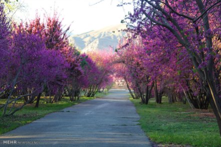
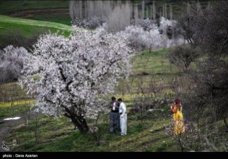
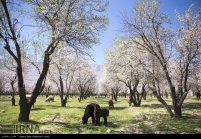
Nowruz, the Iranian New Year celebrated on the day of the spring equinox in the northern hemisphere, has almost arrived and with it we can enjoy the first blossoms across the country: From Rumeshgan in Lorestan, Estur in Kerman, Khaledah and Shiraz in Fars to the gardens of Qazvin.
Sources: Mehr News Agency (MNA) 1, MNA 2, MNA 3, MNA 4, Tasnim News Agency, ISNA, IRNA, Jamejam Online
Photo series: Winter in Iran – Savadkuh County, Mazandaran
The Veresk Bridge and the Three Golden Lines, a railway spiral passing three times by the same area at different heights are located in Savadkuh County, Mazandaran Province. They are part of the Trans-Iranian Railway, a major railway building project that started in 1927 and completed in 1938. It links the capital Tehran with the Persian Gulf and Caspian Sea.
The Danish firm Kampsax began constructing Veresk Bridge in 1934. The structure stands at 110m height and has a 66m long arch. It connects two mountains in the Abbas Abad region.
The construction of this bridge included craftsmen of many nationalities. The name of the bridge is derived from the name of a Czechoslovakian technician whose name was hard to pronounce for Iranians. Near the bridge is a memorial for the workers who lost their life while building the bridge and its nearby tunnels. The Chief Engineer, Austrian Walter Aigner, following his wishes, is buried in the local cemetery of Veresk.
During World War II, it was known as the Pol-e-Piroozi, or the bridge of victory. During the course of the war, Reza Shah was asked by Hitler to blow up all tunnels and bridges, including the Veresk Bridge, on Iran’s railway lines in order to delay the transfer of goods and reinforcement troops to the north for the Russians. He furthermore promised to replace and reconstruct all of such demolished structures following the Germans’ victory in the war. Reza Shah rejected the request. Today trains connecting Tehran to Gorgan or Sari pass over this bridge an average of four times a day.
Sources: Wikipedia | Veresk Bridge, Borna News, highestbridges.com, fouman.com, Wikipedia | Trans-Iranian-Railway
Photo series: Winter in Iran – Enjoying the snow in Sepidan, Fars Province
Sepidan, which means “The Whiteland” in Persian, is a County located in the Zagros Mountains, in Iran’s Fars Province.
The beauty of the region – Sheshpir Lake, vineyards, forests and rivers – coupled with the mild climate in the summer makes Sepidan a popular destination for ecotourism. Roanj and Barmefirooz, 3.720 and 3.706 meters above sea level, are the highest peaks of the county and are covered with snow throughout the year. Margoon Waterfall, Beheshte Gomshodeh (Lost Paradise) and Pooladkaf, one of the best ski resorts in south Iran are at the foothills of these peaks.
Though Sepidan is visited mostly for its nature and landscapes, it can be a destination for historical and archeological tourists. Anshan, which is considered the Cradle of the Achaemenid Empire and Golbahar Tower, built by the Safavids are located also in this county.
Sources: Borna News, ISNA 1, Wikipedia | Sepidan (in French), Wiki Voyage | Sepidan
Photos: Hiking in Iran – Shirbarfy (Snow Lion) near Borujerd
Borujerd is located on the Silakhor Plain, the largest agricultural land in Iran’s Lorestan Province, at approximately 1670 meters above sea level. The Zagros Mountains surround the city from South East to North West. The city of Borujerd is one of the oldest cities in Iran. It owes much of its early development to the Jews that fled to Persia from Mesopotamia.
The people of Borujerd speak mostly the Borujerdi dialect – a distinctive dialect between Lori and Farsi affected by the specific accent common among the Jewish population of Borujerd – Luri, Laki, and the local Judæo-Iranian dialect can be heard as well.
For other posts on nature in Iran click here: Iran’s diverse nature
Photos: The mountains and peaks on the way from Borujerd to Bayranshahr (Chaghalvandy) – along the villages of Zereshgah, Chenarestan, Keyvareh and Buryabaf – are a popular destination for hikers during winter. They are called Shirbarfy (snow lion) and are located at 2995 meters above sea level.
Sources: Wikipedia | Borujerd, Wikipedia | Shirbarfy (in Persian), Mehr News Agency (Photos),
Iran’s Kermanshah Province: Kambadn
Kambadn was an ancient city, located north of ancient Kermanshah. Nowadays, with the expansion of the city the ruins are located between Taq Bostan and Kermanshah. A city named Kambadn was mentioned in Bisutun (Behistun), the inscriptions authored by Darius the Great, and archeological excavations have located this city near Taq Bostan.
Kermanshah is considered one of the cradles of prehistoric cultures. The area has been occupied by prehistoric people since the Lower Paleolithic period, and continued to later Paleolithic periods till late Pleistocene period; with Neanderthal presence in Middle Paleolithic. The region was also one of the first places in which human settlements were established between 8,000-10,000 years ago.
In May 2009 one of the oldest prehistorian village in the Middle East dating back to 9800 BCE, was discovered in Sahneh, located west of Kermanshah. Remains of later village occupations and early Bronze Age are found in a number of mound sites in the city itself.
In ancient Iranian mythology, the construction of the city is attributed to Tahmuras, the third king of Pishdadian dynasty. It is believed that the Sassanids have constructed Kermanshah and Bahram IV – he was called Kermanshah, meaning king of Kerman – gave his name to the city.
Source: IRNA, Wikipedia | Kambadn (Persian), Wikipedia | Kermanshah, amitisiran.blogfa.com
Photo series: Winter in Iran – Dizin Ski resort
Dizin is one of the larger Iranian ski resorts in the Alborz mountain range, near Tehran (43 miles north of the capital city) and also near the city of Karaj. It was established in 1969.
The ski season in Dizin lasts longer than in European ski resorts, from December to May, because of the resort’s high altitude. The highest ski lift reaches 3,600 m (11,800 ft), making it one of the 40 highest ski resorts in the world.
The lowest point of the region is 2650m, while its highest point is 3600m, (which equates to 11,811 feet above the sea level). The snow quality at Dizin is fantastic powder and rivals that of many European and Rocky Mountain snow areas.
The Dizin ski complex is the first ski and winter sport resort in Iran which has been officially recognized and granted the title by the International Ski Federation (FIS) for its capability in administrating official and international competitions. At the present, the Dizin ski region is administered by Iran Ski Federation. The FIS Grass Skiing World Cup is also organized in Dizin since 2012.
Sources: Wikipedia | Dizin, Mehr News Agency | Photos 1, Mehr News Agency | Photos 2
More info on: TripAdvisor | Attraction Review | Dizin
Photo series: Autumn in Iran – Danesfahan, Qazvin Province
Danesfahan is a city of around 9,000 inhabitants (2006) in Buin Zahra County, Qazvin Province, Iran. It is located west of Sagezabad and south of Esfarvarin. Historically, the city has been affected by earthquakes.
Photo gallery: Charming autumn nature in Danesfahan
Sources: Wikipedia | Danesfahan, Mehr News 1, Mehr News 2
Photo Series: Autumn in Iran – Gilan Province
Gilan Province lies along the Caspian Sea, bordering the Republic of Azerbaijan in the north, as well as Russia across the Caspian Sea. The climate is humid subtropical with the heaviest rainfall in Iran. Rasht, the capital of the province, is known within Iran as the “City of Rain”.
Large parts of the province are mountainous, green and forested. The coastal plain along the Caspian Sea is similar to that of Mazandaran, mainly used for rice paddies.
In May 1990 large parts of the province were destroyed by a huge earthquake, in which about 45,000 people died. Abbas Kiarostami made his films Life, and Nothing More… and Through the Olive Trees based upon this event.
Enjoy Gilan’s beauty in autumn:
Photo gallery: Zereshk (barberry) farms in Iran
Berberis vulgaris, also known as European barberry or simply Barberry, is a deciduous shrub, native to central and southern Europe, northwest Africa and western Asia. It grows up to 4m high with yellow flowers that bloom in late spring. The fruit is an oblong red berry, rich in Vitamin C, that ripens in late summer or autumn. Although it has a sharp flavor, people in many countries eat it as a tart and refreshing fruit. The thorny shrubs make harvesting them difficult, so in most places, they are not widely consumed. They are an important food for many small birds, which disperse the seeds in their droppings.
Iran is the largest producer of zereshk and saffron in the world. Zereshk (or sereshk) is the Persian name for the dried fruit of Berberis, specially that of Berberis integerrima ‘Bidaneh’, which is widely cultivated in Iran. Zereshk and saffron are produced on the same land and the harvest is at the same time. In Iran their main production area lies in South Khorasan, especially around Qaen and Birjand. There is evidence of cultivation of seedless barberry in South Khorasan two hundred years ago.
Zereshk is widely used in cooking, imparting a tart flavor to chicken dishes. It is usually cooked with rice, called zereshk polo, and provides a nice meal with chicken. Zereshk jam, zereshk juice, and zereshk fruit rolls are also produced in Iran.
Photos of zereshk farms in Semirom (Isfahan), Birjand and Zohan (South Khorasan)
Sources: Wikipedia | Berberis vulgaris, Mehr News 1, Mehr News 2, ISNA, IRNA
Photo Series: Autumn in Iran – Mazandaran Province
Mazandaran is a Caspian province in the north of Iran. Located on the southern coast of the Caspian Sea, it is bordered clockwise by Russia (across the sea), Golestan, Semnan, Tehran, Alborz, Qazvin, and Gilan provinces. Sari is the largest city and the capital of Mazandaran province.
The diverse nature of the province features plains, prairies, forests and rainforest stretching from the sandy beaches of the Caspian Sea to the rugged and snowcapped Alborz sierra, including Mount Damavand, one of the highest peaks and volcanos in Asia.
Sources: ISNA 1, ISNA 2, Wikipedia | Mazandaran Province
Photo Series: Autumn in Iran – Asalem to Khalkhal road
Khalkhal is the capital of Khalkhal County, in Ardabil Province, Iran. Its population is 38.521 (2006). Asalem is a city in Talesh County, Gilan Province, Iran. Its population is 3.347 (2006).
The road from Asalem to Khalkhal is known for its beautiful landscapes.
Sources: Wikipedia | Asalem, Wikipedia | Khalkhal, Tasnim News Agency, Mehr News, JameJam
Photo series: Autumn in Iran – Snow in Tabriz
Tabriz, located at an elevation of 1,350 meters above sea level, is the capital of East Azerbaijan Province and the most populated city North-Western Iran. With cold winters and temperate summers, the city is considered a summer resort.
Photo gallery: Tabriz covered in early autumn snow
Related content: The other Iran | Tabriz, The other Iran | East Azerbaijan Province
Sources: JameJam Online, Tasnim News Agency, Mehr News 1, Mehr News 2, Wikipedia | Tabriz
Photo Series: Autumn in Iran – A rainy day in Tehran
Iran’s capital, Tehran, with a population of around 9 million in the city and 16 million in the wider metropolitan area, is the largest city and urban area of Iran. The semi-arid climate of the city is largely defined by its geographic location, with the towering Alborz Mountains to its north and the central desert to the south. The weather is mild in spring and autumn, hot and dry in summer, and cold in winter. Because the city is large with significant differences in elevation among various districts, the weather is often cooler in the hilly north than in the flat southern part of Tehran.
Photo gallery: A rainy autumn day in Tehran’s Mellat Park
Source: ISNA, Fars News, IRNA, Tasnim News, Wikipedia | Tehran
Photo Series: Autumn in Iran – Snowfall in Masal, Gilan
Masal, a county in the western part of Gilan Province, encompases the upper valley of the Shanderman River and the whole catchment basin of the Masal River (also called Ḵālekāi) until its arrival into the plain. The local population, 48,000 inhabitants in 2006, speaks Talysh, Gilaki and Persian. Masal and Bazar Jomeh are the only cities in the county.
The main agricultural production is rice, cultivated in the lower valleys and the edge of the plain, in small holdings. Of the three usual complementary resources of the plain (namely sericulture, tobacco, and tea), sericulture is the only one to have had a significant but highly variable role. The impact on this area of the crisis of silk production in the late 2000’s is uncertain. The other main activity and source of income is stock-breeding.
Unlike the valleys adjacent to the north or to the south, this area has no temporary bazaars on summer pastures because of the strong attraction and relative proximity of the Friday bazaar in Shanderman and Saturday bazaar in Masal. In both cases, this commercial activity has launched an urbanization process by gradually gathering services and resident population around the commercial core.
Sources: JameJamOnline, Instagram, Wikipedia | Masal County, Enciclopædia Iranica | Masal
Photo Series: Autumn in Iran – Along the Zayanderud, Chahar Mahal and Bakhtiari
Zayanderud (literally ‘river that gives life’) is the largest river in the central plateau of Iran. It starts in the Zagros mountain range in western Iran and runs 400km to the east before ending in the Gavkhouni Swamp, a seasonal salt lake, southeast of Isfahan city, in the central part of the country.
The Zayanderud Dam had its floodgates opened on Friday to supply the water required for farmers’ autumnal crop growing. The increase in discharge of the Zayanderud is making the landscape along the river even more enjoyable (see photos below).
Photos: The Zayanderud flowing through Chaharmahal and Bakhtiari on its way to the city of Isfahan
Sources: Tasnim News Agency, PressTV
Photo Series: Autumn in Iran – Snowfall in Talesh, Gilan
Talesh is a 200,000 inhabitants county in Gilan Province, Iran. Its capital, Hashtpar (also called Talesh), is situated 140 km north-west of Rasht, on the south-west coast of the Caspian Sea. The region, a mountainous area, outstands with its virgin ant intact nature.
Photos of the first snowfall in Talesh:
The Talysh are one of the oldest inhabitants of the western littoral Caspian Sea and are amongst the native inhabitants of today Iran and neighboring Azerbaijan.
Generally speaking, the land of Talesh has been divided in three regions: Gaskarat, Foumanat and Azerbaijan Taloshian. In Gaskarat, the majority of people speak Taleshi and/or Azeri, Farsi. In Foumanat, most speak Taleshi. Lastly, Talysh from neighboring Azerbaijan are often bilingual and trillingual, consisting of Taleshi, Azeri and Russian speakers. Taleshian people at present are mostly Sunni and Shia Muslims.
Sources: ISNA, Wikipedia | Talesh County
Beautiful landscapes on the road from Pounel to Khalkhal (Photos)
Pounel (Poonel or Punel) is a village of 2,300 inhabitants in Rezvanshahr County, Gilan Province, Iran. Khalkhal lies in the eastern part of the historical Azerbaijan plateau and with a population of 38,521 (2006), is the capital of Khalkhal County, in Ardabil Province.
The main ethnic groups living in Khalkhal are Azeris (95%), followed by Talishs and Tats (3%), Kurds (1%) and Persians (1%).
The road from Pounel to Khalkhal has wonderful sights that can be enjoyed by car. If you like hiking, you can visit Ardeh, a village thirty kilometers from Pounel, with beautiful hiking trails.
Sources: IRNA, Instagram, Panoramio | Alireza Jahaveri, Panoramio | Ali Memari, Panoramio | Peyman Azimi, Wikipedia | Punel, Wkipedia | Khalkhal, Iran Travel Information Forum
Iran’s Hamedan Province: ‘Ganjnameh’ – an ancient cuneiform inscription of the Achaemenid Empire (Photos)
Ganj Nameh, literally translated as “treasure epistle”, is an ancient inscription, 5 kilometers southwest of Hamedan, near a natural waterfall, into a rockface on the side of Alvand Mountain, in Hamedan Province, Iran
The inscriptions were carved in granite in two sections. The one on the left was ordered by Darius the Great (521-485 BC) and the one on the right by Xerxes the Great (485-65 BC). Both sections were carved in three ancient languages: Old Persian, Neo-Babylonian and Neo-Elamite. The incscriptions start with praise of the Zoroastrian God (Ahura Mazda) and describe the lineage and deeds of the mentioned kings.
Ganjnameh sits along the ancient Imperial Road, that connected the Achaemenid capital Ecbatana to Babylonia. It was a safe and frequently traveled road and had much visibility during the Achaemeniad period. The inscriptions were studied in detail by the French painter and archaeologist Eugene Flandin during the 19th century. Subsequently Sir Henry Rawlinson, a British explorer, used the inscriptions to decipher the cuneiform characters of the era.
The translation of the text on the right plate, attributed to Xerxes, is: “The Great God Ahuramazda, greatest of all the gods, who created the earth and the sky and the people; who made Xerxes king, and outstanding king as outstanding ruler among innumerable rulers; I the great king Xerxes, king of kings, king of lands with numerous inhabitants, king of this vast kingdom with far-away territories, son of the Achaemenid monarch Darius.”
Later generations who could not read the Cuneiform alphabets of the ancient Persian assumed that they contained the guide to an uncovered treasure; hence they called it Ganjnameh which literally means “treasure book”, but it has also been called Jangnameh, literally “war book”, possibly due to the wrong assumption that the inscriptions described ancient wars of the Achaemenid era.
Two modern contemporary carved tablets have been placed in the site’s parking lot with Persian explanation and its English translation.
Unfortunately, this archeological site is in danger due to the construction of restaurants and entertainment centers in the vicinity of Ganjnameh that have changed the historic atmosphere and endangered the cultural and natural landscape of the area. Adding to these existing problems is the construction of a cable car nearby.
Sources: Historical Iran | Ganjnameh, Wikicommons | Ganj Nameh inscriptions, Mehr News Agency | Photos, tishineh.com | Ganjnameh, Panoramio | M. Eskandari, Panoramio | Alexandru Velcea, Panoramio | Mauro – Iran 2013, Panoramio | Ehsan Khanjani, Cultural Heritage News Agency (in Persian)
Badab-e Surt Spring, Iran – naturally formed staircase built over thousands of years
Badab-e Surt’s springs are two distinct mineral springs with different natural characteristics, located at 1,840 metres (6,040 ft) above sea level in Mazandaran Province in northern Iran
Over the course of thousands of years the water from these two springs emanating from the mountain range have combined and resulted in a number of orange-, red- and yellow-colored pools shaped as a naturally formed staircase.
Other interesting photos of Iran: The other Iran | Photos
Sources: Wikipedia | Badab-e Surt, Bing (pictures)
Iran’s East Azerbaijan Province: Beautiful nature of Arasbaran (Photos)
Arasbaran is a large mountainous area stretching from the Qusha Dagh massif, south of Ahar, to the Aras River in East Azerbaijan Province of Iran. The region enjoys great history as well as magnificent nature and landscapes; peaks as high as 2,200 meters, alpine meadows, rangelands, forests, rivers and springs. Since 1976, UNESCO has registered 72,460 hectares of this region as biosphere reserve.
Related article with more information about Arasbaran:
The other Iran | Photo Series: Spring in Iran – Arasbaran, East Azerbaijan Province
Sources: Tasnim News Agency | Photos, Mehr News Agency (Photos)
Iran’s Tehran Province: Tangeh Savashi (Photos)
Tangeh Savashi (or Tangeh Vashi) is a gorge and narrow mountain pass in the Alborz range. Located 15 kilometers west of Firouzkouh, the narrow gorge was created by a perennial stream which comes down from a series of waterfalls upstream.
Slightly lower, in a hilly area, the stream provided a patch of lush grazing land within the mountains. Until the 20th century the area was a royal hunting reserve, populated by various wildlife. Fath Ali Shah (1772 – 1834), Qajar Shah of Persia, maintained a hunting lodge there and to commemorate his hunts he ordered the carving of a relief in the mid way point of the pass. There are ruins of a Qajar guard tower at the top of one of entrances to the gorge.
Today, the relief is a popular tourist attraction and the location is also highly popular among trekking and hiking fans.
Sources: Wikipedia | Tangeh Savashi, Wiki Commons | Tangeh Savashi, Mehr News | Photos
Iran’s Mazandaran Province: A glimpse at its beautiful and diverse nature (Photos)
Mazandaran Province is located in the north of Iran, on the southern coast of the Caspian Sea, with Sari as its provincial capital.
The diverse nature of the province features plains, prairies, forests and rainforest stretching from the sandy beaches of the Caspian Sea to the rugged and snowcapped Alborz mountain range, including Mount Damavand, one of the highest peaks and volcanos in Asia. The Alborz Mountain Range surrounds the coastal strip and plains of the Caspian Sea like a huge barrier.
The province enjoys a moderate, subtropical climate with an average temperature of 25 °C in summer and about 8 °C in winter. Although snow may fall heavily in the mountains in winter, it rarely falls at sea level.
 This region has a variety of climates, including the mild and humid climate of Caspian shoreline and the moderate and cold climate of mountainous regions. In the 1,500- to 3,000-meter altitudes, snow covers parts of the province even up to the middle of the warm season. In fact, snow can be observed in this region even in the warmest months of the year, which lends a touch of beauty to this region.
Human habitation in the area dates back at least 75,000 years. Recent excavations in Goher Tippe provide proof that the region has been urbanized for more than 5,000 years, and the area is considered one of the most important historical sites of Iran. Mazandaran was a part of the ancient Persian province of Hyrcania.
The population is overwhelmingly Mazandarani, with a minority of Azerbaijanis, Georgians, Armenians, Circassians, Turkmen and others. Mazandaran is a center for Iranian culture and has produced a number of famous poets. The people are largely secular, and consequently women have had greater social freedom and independence than their Persian cousins. The cuisine of the province is very rich in seafood due to its location by the Caspian Sea, and rice is present in virtually every meal. Indeed, the rest of Iran was introduced to rice through Gilan and Mazandaran.
Sources: Wikipedia | Mazandaran, Mehr News | Photos 1, Mehr | Photos 2, WikiCommons | Mazandaran, Fars News | Photos, Tasnim News | Photos, Iran Chamber Society | Mazandaran
Iran’s Fars Province: Tarom Waterfall near Neyriz
Tarom waterfall is located in the Fars province five kilometers south of the city of Neyriz. Tarom waterfall is about 115 meters high, and thus is the highest waterfall in the Middle East.
 Neyriz (also Romanized as Neyrīz and Nīrīz) is the capital city of Neyriz County, Fars Province, Iran. It has a population of 45,000 inhabitants (2006).
Sources: ISNA | Photos, Wikipedia | Neyriz, Tishnieh.com (Farsi)
Iran’s Golestan Province: Ghale Maran near Ramian (Photos)
Ghale Maran is a peak of high altitude in Ramian County, Golestan Province. It is said that there was ancient castle located top of this mountain, south of Ramian, a 12,000 inhabitants city (2006), in Golestan Province, in northern Iran.
Iran’s Chaharmahal and Bakhtiari Province: Beautiful Koohrang (Photos)
Kuhrang (Koohrang) County lies in Chaharmahal and Bakhtiari Province in central Iran. The capital of the county is Chelgard. Rural areas in Koohrang have a temperate climate with beautiful landscapes.
During Spring, from early April to early May, grow fritillaria imperialis, called often “inverted tulip” in Iran. Its main habitat is Zagros Mountains and the greatest flowers are found in Kuhrang.
The Lion Tombstones (shir-e sangi or bardshir) are a type of tombstone in the form of a lion, found mostly on the graves of Lor and Qashqai (Ghashghai) nomads in the west, southwest, and parts of southern Persia. The major concentration of these statues in today’s Iran are in the province of Khuzestan.
These lions statues stare out from isolated Bakhtiari graveyards in many valleys and across the Zagros Mountains, along the migration routes of the tribes. They mark the graves of unknown chiefs and warriors who died in local battles and can be found individually and in clusters.
Sources: Tasnim News | Photos, IRNA | Photos 1, IRNA | Photos 2, Wikipedia | Kuhrang County, Enciclopædia Iranica | Lion Tombstones, Mehr News | Iran home to inverted tulips
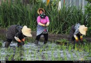
Rice fields in Iran (Photos)
Iran is a vast country, covering 1,648,000 km2 (164.8 million ha). Its topography is dominated by two mountain ranges – Alborz and Zagros – while two great deserts extend over much of the central region, leaving about 20 million ha for crop production. On account of the highly diverse climatic and soil conditions, only 12.5 million ha are cultivated annually with a wide range of food crops. Wheat, rice and barley are the most important cereals cultivated.
Rice is the staple food in Iran, with the quality of cooked rice outweighing all other considerations for Iranian consumers. The total area under rice is more than 600 thousand ha and rice is now grown in varying degrees in nearly all provinces of Iran. However, more than 80 percent of rice area is distributed in the two northern provinces of Mazandaran and Gilan.


Iran’s rice production in 2011 was 2.4 million tons, which increased from a total of 2.3 million tons in the previous year. Iran has 3,800 rice milling units (2009). Iran has imported about 1.4 million tons of rice from UAE, Pakistan and Uruguay worth $800 million in 2009. Iran’s rice imports drop by 40% in 2010. The average per capita consumption of rice in Iran is 45.5 kg, which makes Iranians the 13th biggest rice consumers.
The photos were taken in different Iranian provinces: Qazvin, Gilan, Kurdistan, North Khorasan, Fars and Kohgiluyeh and Boyer-Ahmad.
Sources: Food and Agriculture Organization of the United Nations (FAO) | The rice situation in Iran by N. Shobha Rani, Wikipedia | Agriculture in Iran, Encyclopaedia Iranica | Berenj “rice”, Mehr News Agency | Photos, MNA | Photos, Tasnim News Agency | Photos 1, Tasnim | Photos 2, Tasnim | Photos 3, Tasnim | Photos 4, IRNA | Photos, ISNA | Photos 1, ISNA | Photos 2
Iran’s Kerman Province: Rageh Canyon (Photos)
The Rageh canyon is one of the unique and beautiful natural places, in the desert of Rafsanjan County. It was created by the floods and soil erosion of the Givdary River over twenty thousand years. This 20km long, 70m deep and 180m wide valley, with sharp conical peaks, blades and strip wise walls, has interesting and various spatial shapes, narrow and wide passages alongside the river and valley walls.
The nearest city to Rageh Canyon is Rafsanjan, the capital of Rafsanjan County. It is Iran’s center of pistachio cultivation and also a major center of carpet production even though the rugs are sold as Kermani rugs rather than Rafsanjani ones. Another large employer is the nearby Sarcheshmeh copper mines.
Sources: Wikipedia | Rafsanjan (in English), other sources in Persian: ISNA | Photos, Mehr News Agency | Photos, Mehr News Agency | News, rageh.ir.
Iran’s Sistan and Baluchestan Province: Martian mountains near Chabahar (Photos)
Mars or Martian Mountains, also known as Koohaye Merikhi in Persian, are a type of badlands stretched out parallel to the Gulf of Oman from Kacho Village (35km east of Chabahar) to Gwatar. They are the result of millions of years of erosion and are considered to be a symbol of the unique geo-morphological phenomena of Chabahar.
Locals named them Martian Mountains, since it seemed as if aliens – in this case people from Mars – built them; with almost no vegetation and its torn and very sharp cutted forms, they stand in strong contrast with the landscape around.
Chabahar is Iran’s southernmost city, situated on the Makran Coast of the Sistan and Baluchestan Province, it is also a free trade zone on the coast of the Gulf of Oman.
In Persian char means four and bahar means Spring. Hence, the city was named as the place where all four seasons are Spring. The majority of the city’s inhabitants are ethnic Baluch who speak the Baluchi language. At the 2006 census, its population was 71,070 inhabitants.
Sources: Wikipedia | Chabahar, Fars News | Photos (Apr. 2014), Fars News | Photos (Feb. 2014). In Persian: irandeserts.com, Mehr | News, and Deutsche Welle.
Iran’s Isfahan Province: Khansar’s nature
Khansar (also Romanized as Khvansar, Khunsar) is a 900km² mountainous county, situated in a green valley, about 2300 meters above sea level, in Isfahan Province, Iran. It includes 18 villages in 3 rural districts and one central city; Khansar. The county has a population of about 32,000 inhabitants. Hacham Uriel Davidi (1922–2006) and national football player Ali Shojaei are notable Khansaris.
Khun means spring and sar means place in Avestan language, so khansar means place of the spring. The languages spoken in the city are Khunsari (Khwanshari), a northwestern Iranian language, and Judeo-Khunsari, a Judæo-Persian language spoken in Khansar and elsewhere in the far-western Isfahan Province.
The city of Khansar is situated on both sides of a narrow valley through which the Khunsar River flows. The town and its gardens and orchards straggle some 10 km along the valley. Khansar is famous for its honey, flower-filled gardens and a great profusion of fruit.
The principal centers of Gazz Angebin production in Iran are the mountainous pasture-lands of this region. Gazz Angebin, indirectly extracted by an insect from a plant, is one of the main ingredients of Gazz (Iranian Nougat). Khansar has also famous hand-woven rugs called Weis in polygonal shapes.
Sources: Wikipedia | Khvansar, Wikipedia | Khvansar County, Mehr News Agency | Photos
Iran’s Isfahan Province: The Zayandeh-Rood
Beautiful photos of Isfahan’s bridges!
 The Zayanderud (Zayandeh River) is the largest river in the central plateau of Iran. It crosses directly through the city of Isfahan. In 2010, the river dried out completely after several years of draught. Today the river flows with water once again, however the city continues to close and open the dam throughout the year depending on water shortages throughout the districts. The water that forms the river originates from the inside of the Zagros Mountains and flows 400 kilometers. The 400 km of river is spanned by may historical bridges that were built in the Safavid era. The Zayanderud is the reason for the prosperity of the central Iranian provinces of Isfahan and Yazd. Two of the most famous bridges on the Zayanderud are the Siosepol (33 Bridge) and Pol-e Khaju (Khaju Bridge).
 Women wearing head-to-toe hijab are having kayaking practice on the Zayanderud. They are padding upstream while…
View original post 336 more words


