Tag Archives: Hamedan Province

Photo Series: Autumn in Iran – Hamedan Province (Part 3)

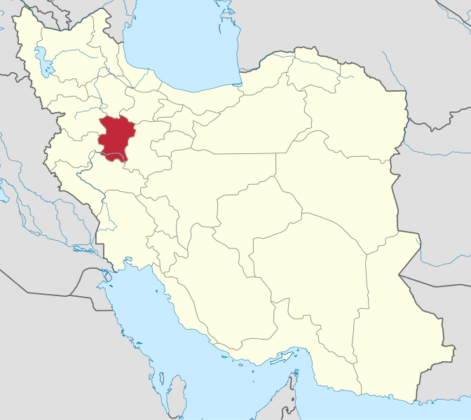
Hamedan Province is one of the most ancient regions of Iran. The city of Hamedan laid on the Silk Road. The Province lies on the Zagros mountain range. Hamedan enjoys temperate warm summers and relatively cold winters.

According to local Jewish traditions, Hamedan is mentioned in the Book of Esther as the capital of Ancient Persia in the days of King Ahasuerus. It was then known as Shushan. The Tombs of Mordecai and Esther are located in modern-day Hamedan.

Related articles:
The other Iran | Autumn in Iran
The other Iran | Hamedan Province

Sources: Mehr News 1, ISNA 1, ISNA 2, Tasnim News, Wikipedia | Hamedan, Mehr News 2

Photos: Nowruz and the Year of the Monkey combined in Hamedan

Nowruz, as the Iranian New Year is called in Persian, means “new day” and falls on the first day of the spring equinox every year. It is an ancient ritual dating back 2500 years and is rooted in Zoroastrianism. The Chinese Lunar New Year is also known as Spring Festival, as the season signifies a new start from the depths of winter, carrying the same meaning as in Iranian culture.

This is the Year of the Monkey in Chinese zodiac. Hence, the city of Hamedan included it in its urban decoration for Nowruz, placing monkeys along the different haft-seen elements.

Haft-Seen is the traditional table setting of Nowruz in Iran. It includes seven items starting with the letter S (called seen in Persian alphabet): sabzeh (greenery: wheat, barley or lentil sprouts grown in a dish), samanu (a sweet pudding made from germinated wheat), senjed (the dried fruit of the oleaster tree), sir (garlic), sib (apples), somagh (sumac berries) and serkeh (vinegar).

Other symbolic items which are usually set along the Haft Seen are candles, a mirror, decorated coins (sekkeh in Persian), spring flowers like hyacinth (sonbol in Persian) or tulips, decorated eggs, a bowl of water with goldfish, a holy book and/or a poetry book, rose water and pomegranates.

Related articles: The other Iran | Customs & Traditions

Sources: IRNA, Nafee.ir, Wikipedia | Nowruz

Photo gallery: Domino competitions in Hamedan, Iran

Different domino tournaments were organized at Hamedan’s Azad University during the last weeks. The competitions for middle and high schoolers took place early November with around one hundred participants in twenty five teams from Hamedan and Lalejin. Twelve teams competed late November during the tournament for university students.

Sources: ISNA 1, ISNA 2, Tasnim News Agency, hamedan.ir, Young Journalists Club

Winners of the International Theater Festival for Children and Youth 2015 in Hamedan, Iran (Photos)

The winners of the 22nd International Theater Festival for Children and Youth were introduced during the closing ceremony held on Tuesday, October 6th, in Hamedan.

Veteran Iranian director, Marzieh Boroumand, was honored for her lifetime achievements. Boroumand is most famous for her hits “Grandmother’s Home” and “School of Mice”, two popular puppet series from the 1980s.

About fifty theater troupes from nine different countries attended early October to the 22nd International Theater Festival for Children and Youth.

Related article: International Theater Festival for Children and Youth in Hamedan, Iran (Photos)

Sources: Tavoos Online, Mehr News Agency, ISNA, IRNA

International Theater Festival for Children and Youth in Hamedan, Iran (Photos)

Hamedan hosted early October the 22nd edition of the International Theater Festival for Children and Youth. About fifty theater troupes from nine countries, among others Italy, Germany, Finland, Russia and England, attended the festival and competed in different sections (children, youth and international). Besides their performances the troupes also arranged several workshops.

Sources: Tavoos Online, IRNA, ISNA, Mehr News 1, Mehr News 2, Mehr News 3, Honar Online

Iran’s Hamedan Province: ‘Ganjnameh’ – an ancient cuneiform inscription of the Achaemenid Empire (Photos)

Ganj Nameh, literally translated as “treasure epistle”, is an ancient inscription, 5 kilometers southwest of Hamedan, near a natural waterfall, into a rockface on the side of Alvand Mountain, in Hamedan Province, Iran

The inscriptions were carved in granite in two sections. The one on the left was ordered by Darius the Great (521-485 BC) and the one on the right by Xerxes the Great (485-65 BC). Both sections were carved in three ancient languages: Old Persian, Neo-Babylonian and Neo-Elamite. The incscriptions start with praise of the Zoroastrian God (Ahura Mazda) and describe the lineage and deeds of the mentioned kings.

Ganjnameh sits along the ancient Imperial Road, that connected the Achaemenid capital Ecbatana to Babylonia. It was a safe and frequently traveled road and had much visibility during the Achaemeniad period. The inscriptions were studied in detail by the French painter and archaeologist Eugene Flandin during the 19th century. Subsequently Sir Henry Rawlinson, a British explorer, used the inscriptions to decipher the cuneiform characters of the era.

The translation of the text on the right plate, attributed to Xerxes, is: “The Great God Ahuramazda, greatest of all the gods, who created the earth and the sky and the people; who made Xerxes king, and outstanding king as outstanding ruler among innumerable rulers; I the great king Xerxes, king of kings, king of lands with numerous inhabitants, king of this vast kingdom with far-away territories, son of the Achaemenid monarch Darius.”

Later generations who could not read the Cuneiform alphabets of the ancient Persian assumed that they contained the guide to an uncovered treasure; hence they called it Ganjnameh which literally means “treasure book”, but it has also been called Jangnameh, literally “war book”, possibly due to the wrong assumption that the inscriptions described ancient wars of the Achaemenid era.

Two modern contemporary carved tablets have been placed in the site’s parking lot with Persian explanation and its English translation.

Unfortunately, this archeological site is in danger due to the construction of restaurants and entertainment centers in the vicinity of Ganjnameh that have changed the historic atmosphere and endangered the cultural and natural landscape of the area. Adding to these existing problems is the construction of a cable car nearby.

Sources: Historical Iran | Ganjnameh, Wikicommons | Ganj Nameh inscriptions, Mehr News Agency | Photostishineh.com | Ganjnameh, Panoramio | M. Eskandari, Panoramio | Alexandru Velcea, Panoramio | Mauro – Iran 2013, Panoramio | Ehsan Khanjani, Cultural Heritage News Agency (in Persian)

Iran’s Hamedan Province: Ali Sadr Cave – The world’s largest water cave

Hamedan Province, Iran - MapThe Ghar-e Ali Sadr is the world’s largest water cave which attracts millions of visitors every year. It is located in Ali Sadr Kabudarahang County about 100 kilometers north of Hamedan, western Iran.

Excavations and archeological studies of the cave have led to the discovery of ancient artworks, jugs and pitchers dating back to 12,000 years ago. Animals, hunting scenes and bows and arrows are depicted on the walls and passages of the exit section. These images suggest primitive man used the cave as their abode. The cave was known during the reign of Darius I (521-485 BC) which can be verified by an old inscription at the entrance of the tunnel. However, the knowledge of the existence of the 70 million-year-old cave was lost, and it was only rediscovered in 1963 by Iranian mountaineers.

The cave is entered at the side of a hill called Sari Ghiyeh which also includes two other caves called Sarab and Soubashi, each 7 and 11 kilometers from Ali Sadr Cave.

Apparently, the water in Ali Sadr cave stems from a spring in Sarab. In the summer of 2001, a German/British expedition surveyed the cave, finding to be 11 kilometers long. The main chamber of the cave is 100 meters by 50 meters and 40 meters high.

The cave walls can extend up to 40 meters high, and it contains several large, deep lakes. The cave has a river flowing through it and most travel through the cave system is done by boat. More than 11 kilometers of the cave’s water canals have been discovered so far. Some routes are 10 to 11 kilometers long and all lead to “The Island”, a centrally located large atrium.

More articles on Iran’s nature: The other Iran | Nature

Sources: Wikipedia | Ali-Sadr Cave, IRNA | Photos, Alisadr Toursim Co | Portfolio, Wikimedia Commons | Ali Sadr Cave

Photo Series: Autumn in Iran – Hamedan Province (Part 2)

Some beautiful pictures of Hamedan in autumn:

You can find another photo gallery of this beatiful region and some information about Hamedan in: The other Iran | Photo Series: Autumn in Iran – Hamedan Province (Part 1)

Source: IRNA

Photo Series: Autumn in Iran – Hamedan Province (Part 1)

Hamedan Province is one of the 31 provinces of Iran. It covers an area of 19,546 km² and has a population of over 1,82 million (2008). Its capital is Hamedan city. Hamedan province is one of the most ancient parts of Iran and its civilization. The city of Hamedan laid on the Silk Road.

The province lies in an elevated region with the ‘Alvand’ mountains running from the north west to the south west. These are part of the Zagros mountain range. Hamedan enjoys temperate warm summers and relatively cold winters.

According to local Jewish traditions, the City of Hamedan is mentioned in the Book of Esther as the capital of Ancient Persia in the days of King Ahasuerus. It was then known as Shushan. The Tombs of Mordecai and Esther are located in modern-day Hamedan.

Today’s Hamedan is what is left of Ecbatana, The Medes’ capital before they formed a union with the Persians. The poet Ferdowsi says that Ecbatana was built by King Jamshid. During the Parthian era Hamedan became the summer capital and residence of the Parthian rulers. After the Parthians, the Sassanids constructed their summer palaces in Hamedan as well.

Sources: ISNA, Mehr News Agency, Wikipedia | Hamedan Province